The Mountains of Arizona
www.surgent.net |
|
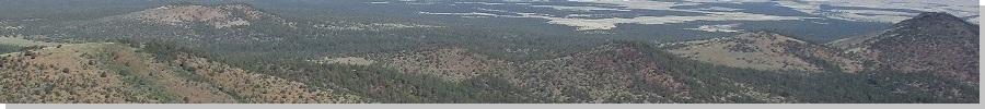
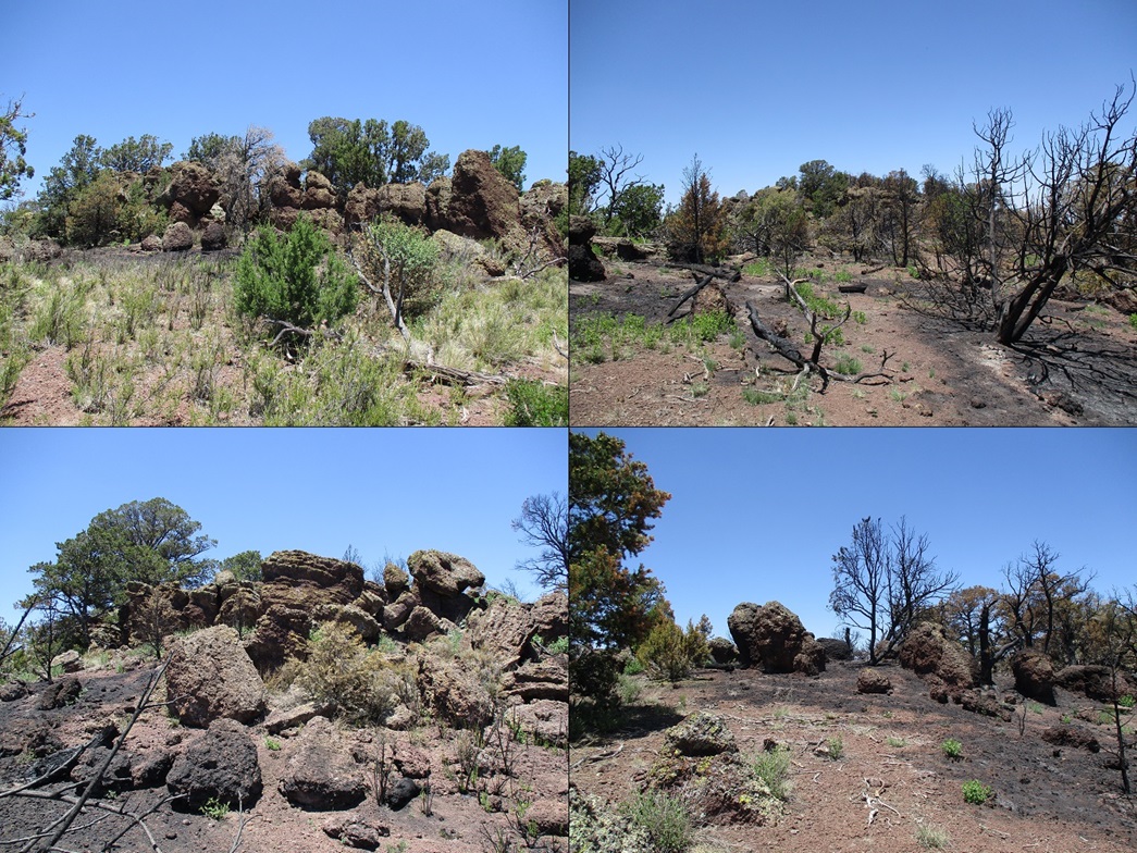
Spring Valley Mountain • Spring Valley Coxcomb South These four peaks are clumped together in the northwestern San Francisco Volcanic Field, closer to Williams than Flagstaff. The main peak here is Spring Valley Mountain, prominence of 802 feet, by far the most sticking-up-over-the-forest peak in this sector. The other three peaks were nearby with convenient road access. If we could drive to where we wanted to, none of the hikes would be longer than 3 miles. The first big heatwave was starting up, temperatures over 110 F in the deserts, and mid-80s in the higher elevations. This time of the year, pickings are slim as hiking anywhere lower means hiking in the heat. Even at 5,000 feet elevation, temperatures can get above 100 degrees. We knew it would be very warm where we would be so we got an early start, meeting at the Denny's at the Carefree Highway/Interstate-17 at 4:30 a.m.. The drive to Flagstaff went well. We stopped in Parks to top the gas and for me to get some snacks, then started into the forest roads, aiming for our first peak, Spring Valley Mountain. It would be our longest hike with most elevation gain, and we wanted to get it done first.
Date: July 1, 2023
• Elevation: 7,942 feet
• Prominence: 802 feet
• Distance: 2.7 miles
• Time: 2 hours
• Gain: 745 feet
• Teammate: Matthias Stender
• Prog-rock bands played: Barbara Dennerlein, UK, Homunculus Res, Allan Holdsworth, Cartoon
• Conditions: Clear, sunny, very warm
Arizona
•
Main
•
PB
•
LoJ
•
USGS Datasheet
•
Interactive map
We followed a series of Kaibab National Forest Roads, mainly FR-141 (Spring Valley Road), to FR-260 (as printed on the map, it's FR-730 in the field and signed for Laws Spring). We followed this road north to a Y-split, going right, then at another Y-split, we stayed right (straight), and left at yet another junction, and rumbled along a marginal road to a point immediately south of Spring Valley Mountain. The roads shown on the map are accurate, but the numbers vary, and I did not keep track of them. The road itself was decent, except for a short stretch past the second Y-split where it was much rockier for a few dozen yards and likely would have stopped me had I been in the Forester.
We parked in a clearing, time roughly 7:30 a.m.. It was sunny and pleasant for now, air temperature about 70 degrees. But the sun was intense and its heat was already evident even at this early hour. Every insect was awake and busy jumping and flying every-which-way.
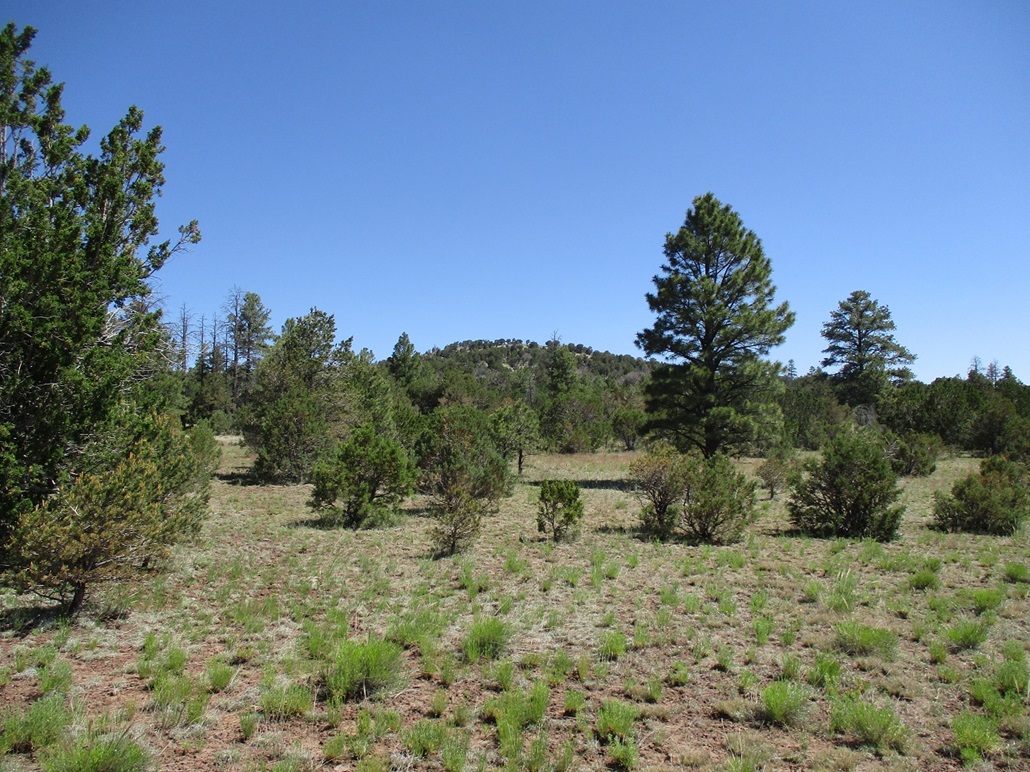
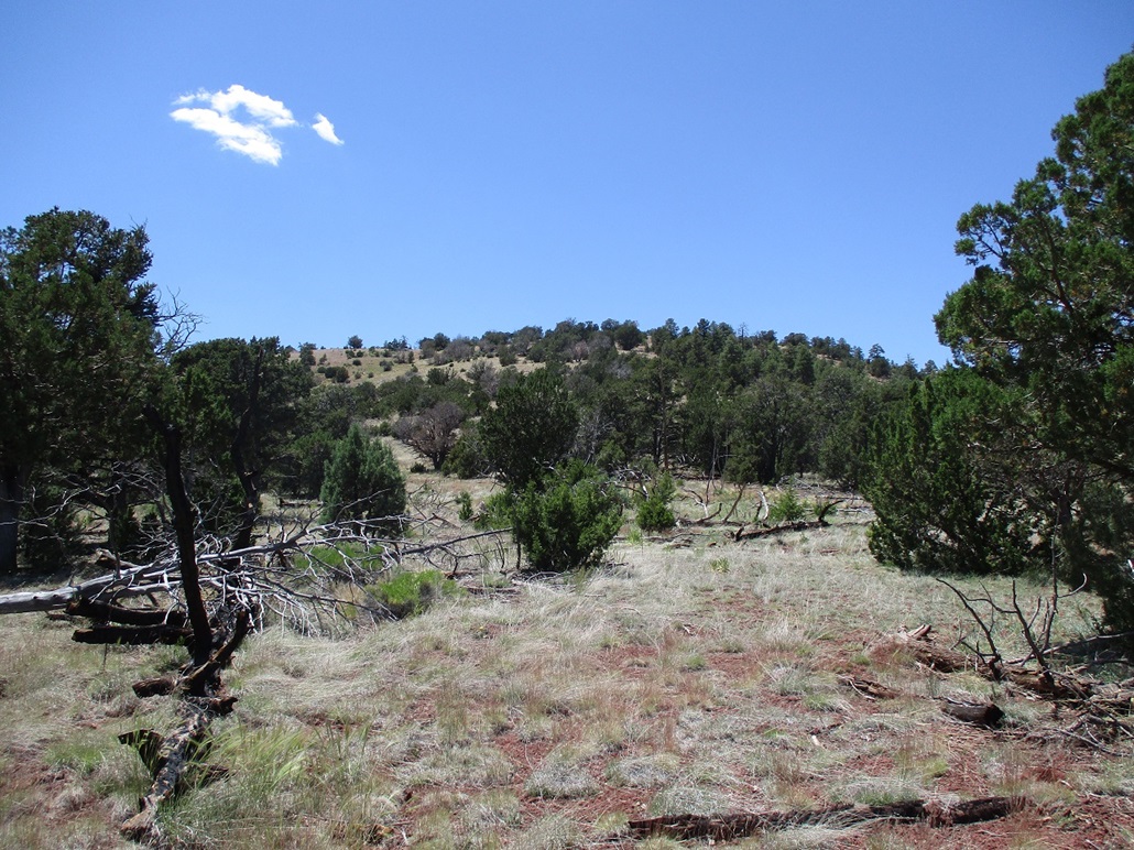
We hiked north up the long south-trending ridge. The terrain was moderately-thick forest with grassy openings and lanes, and light underbrush. The ground was mostly a mix of grass, downed trees and twigs, and rolling rocks. But the gradient was very gentle and we made good time marching upward. Roughly halfway up, we came into a large meadow with a good view of the summit up ahead.
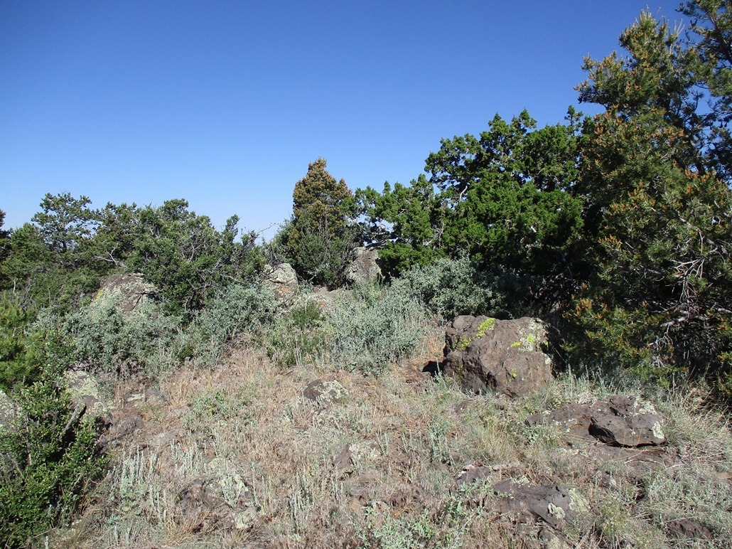
Back into the trees, we hiked upward, up and down a rocky mound, then steeply up the final hundred feet to top out on the peak, about a mile and a half and 750 feet higher from where we started, taking about an hour. The top is a mix of rocks, low trees and thick grass. We found the top rock and tagged it. We also found two of the reference marks, but not the benchmark itself. We could not find a register either.
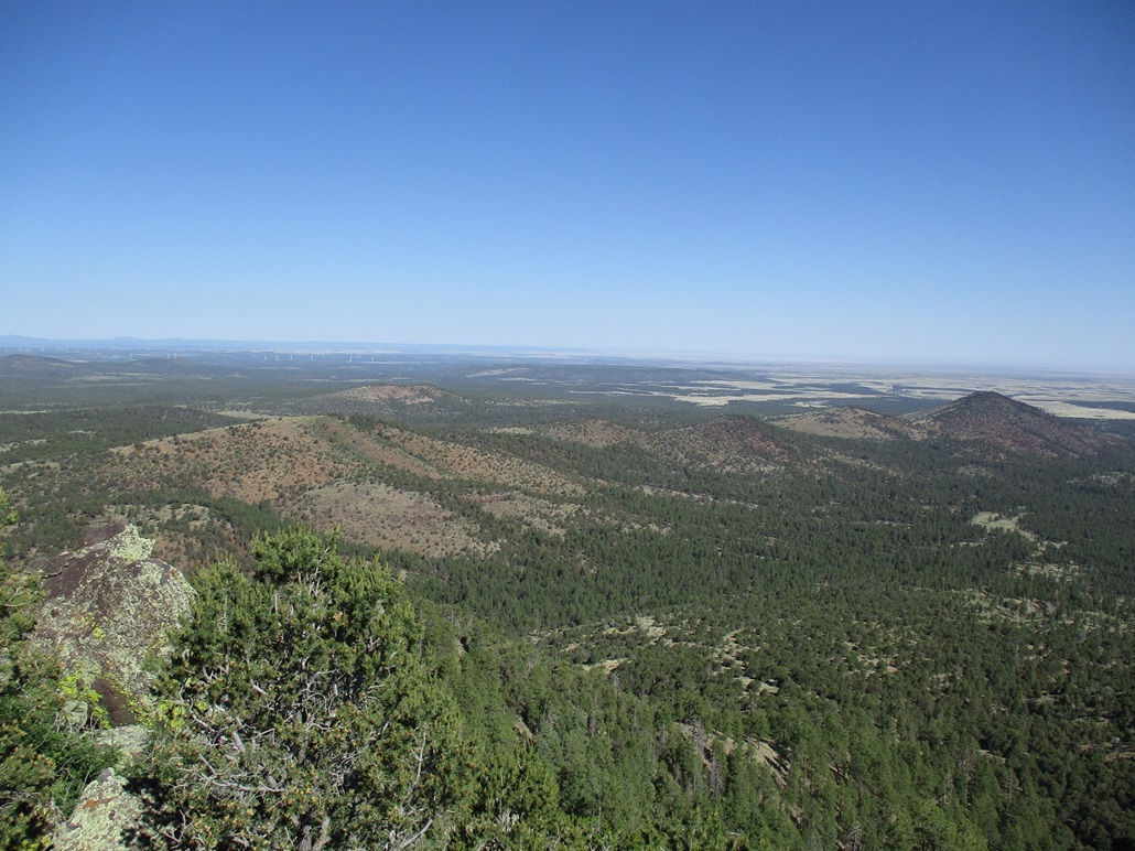
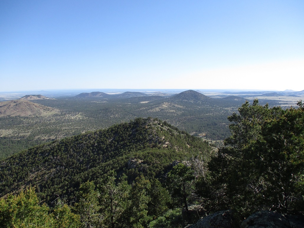
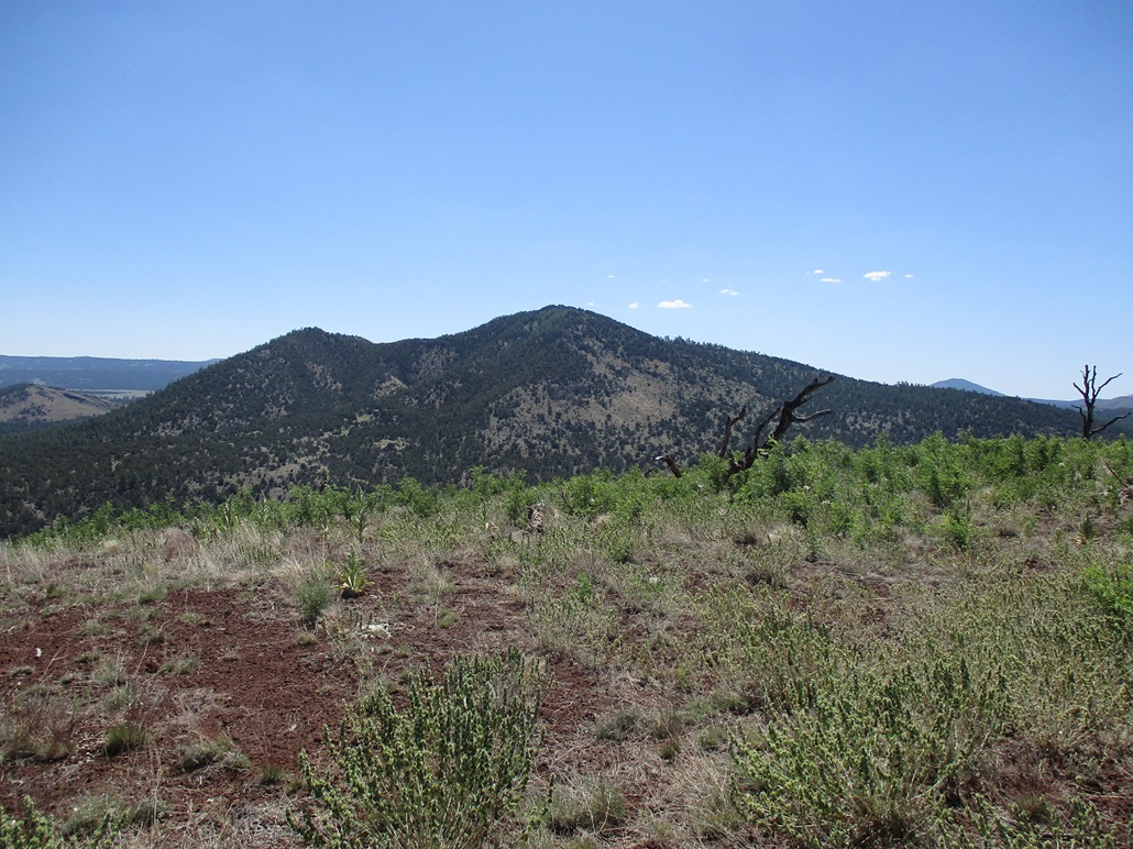
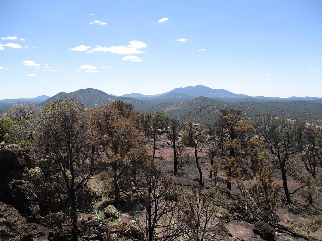
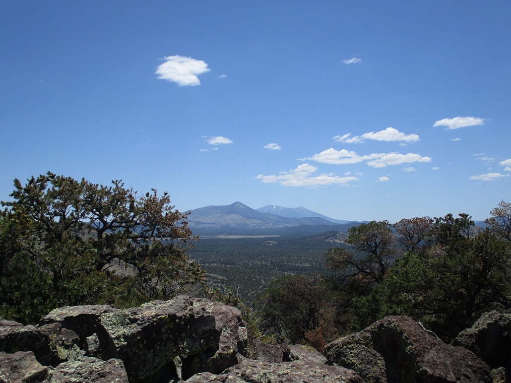
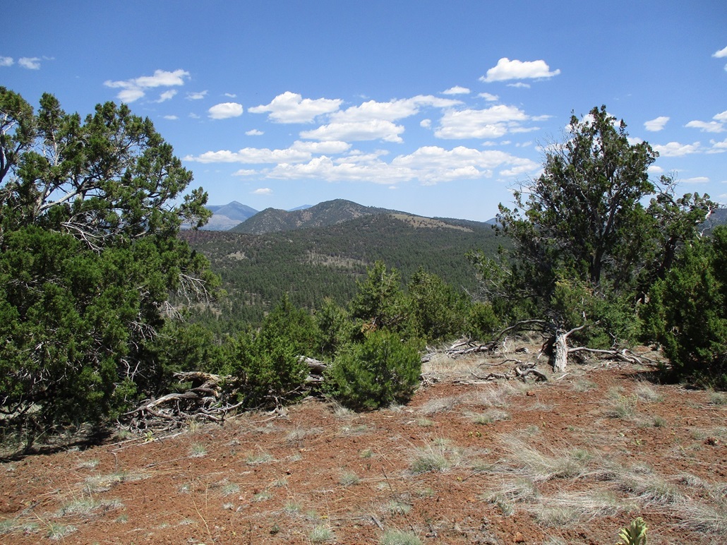
The views were excellent. Looking north and west, we could see the next three peaks on our agenda, as well as the many other hills and bumps of the San Francisco Volcanic Field. We would have to move about to find openings for views in other directions, but we had a full 360-degree panorama. The sun was still low in the east and glared out views that way. Big Sitgreaves Mountain stood high immediately to the south.
We took a break here, spending about 15 minutes on the summit, having a snack and a drink and batting away the bugs. It was warm, but a soft breeze would sometimes blow through, which felt good, just enough to cool one down.
We hiked down the same way, taking about 45 minutes. Back at Matthias' vehicle, we piled in and retraced our drive back to the main road (260/730), with the southern of the two main "Coxcomb" peaks next on the docket.
Elevation: 7,395 feet
• Prominence: 355 feet
• Distance: 1.7 miles
• Time: 1 hour
• Gain: 419 feet
• Conditions: Much warmer
PB
•
LoJ
We followed a fairly decent road northwest toward Little Boulin Tank, and parked a little beyond it in the shade of a big tree. This hike did not expect to take very long, being a simple walk up an open slope to a grassy top.
The "Coxcombs" are a set of hills of which this is the highest of them. Another hill to the north is the only other ranked hill in the grouping. Ironically, it is slightly lower in elevation but has more prominence. The name presumably is inspired by the coxcomb of a rooster, that bumpy fleshy ridge on top of its head. Someone in the 1800s apparently thought these hills looked like that.
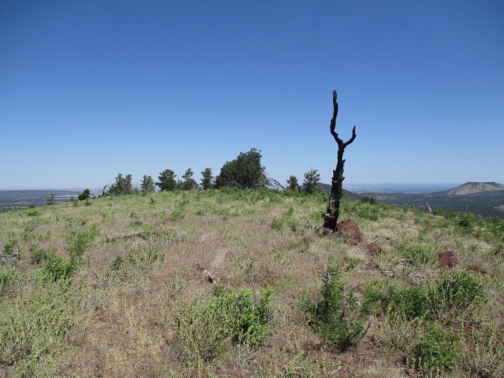
We hiked the road briefly, then angled north into the trees and open slopes. The last half was essentially in the open, a long gentle uphill that never seemed to end. The summit is a simple grassy hump, a large rock abutting a dead blackened tree. After walking around the top looking for a register (we did not find one), we surmised that the rock may be the highest point.
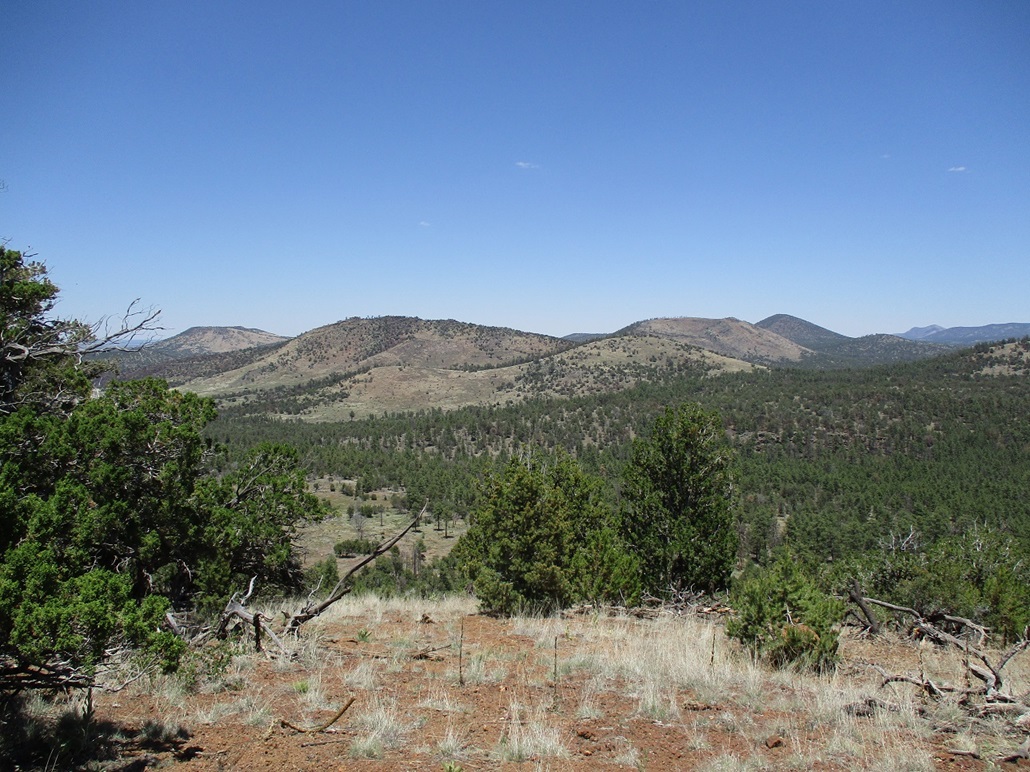
Views were good. Spring Valley Mountain, which we just climbed, stood just a mile from us, much bulkier looking than how it looked from the south. It is the biggest peak in this local cluster.
We didn't stop. After wandering the top for a few minutes, we hiked down the same slope back to the vehicle, roughly a one-hour hike.
We elected to follow the road northeast and approach the North Coxcomb Peak that way. The road was rough. One creek crossing likely would have been impassable in the Forester. The creek itself was dry but heavily eroded. Otherwise, the road was just haggard, lots of small rocks and ruts. No one gets back this far and it appears the roads are not maintained regularly.
It didn't take long, perhaps 15 minutes, to place ourselves at the start of the North Coxcomb hike. It was toasty by now, into the 80s.
Elevation: 7,341 feet
• Prominence: 421 feet
• Distance: 1.8 miles
• Time: 1 hour
• Gain: 499 feet
• Conditions: Hot and buggy
PB
•
LoJ
We parked again under a tree beside the road, a little less than a mile south of the peak which we could see rising above the trees. From a distance, it appeared this peak would be more of a challenge than the first two, there being some obvious rocky segments on its high ridge.
We aimed north, walking across the open ground and bypassing Hill 7167 on its east flank, coming to the saddle that connects Hill 7167 to the North Coxcomb. We even found a path here.
We then marched up the south slopes of North Coxcomb, nothing exciting to report on. Soon, we were at the foot of a cliff, the rocks formed into walls about 15 feet tall. We found an easy passage through a cleft. Beyond it, there was another rocky hill. Might this be the top? Matthias' GPS said no, we still had some distance to cover.
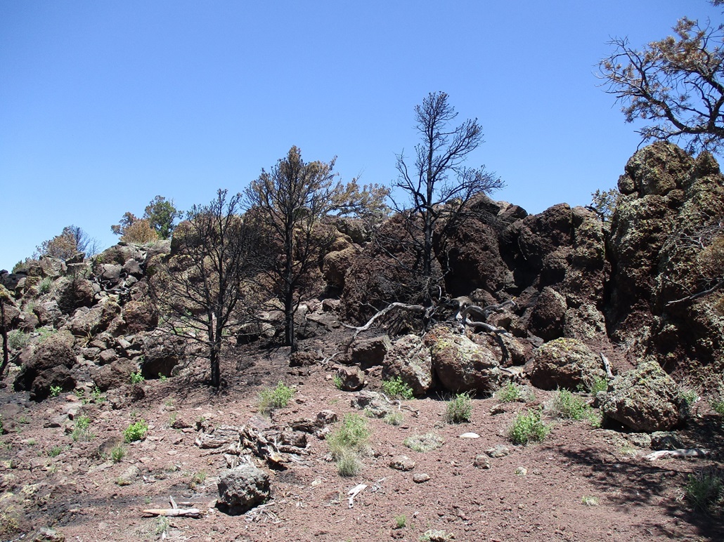
We got up this second rock barrier, then aimed for what appeared to be the top, another rock jumble. But when we got there, yet another rock outcrop was visible, a few dozen yards north. This was finally the summit. We got up it with our only "scramble" of the day, about a ten-foot clamber.
We found a register (yay) hidden in a crevice, and signed in, only the fourth and fifth people since 2017, when it was placed. The top has perfect block-shaped sitting rocks, so we took a longer break here.
There had been a fire up here recently, but the fire did not appear to be a big fire. It seemed to burn in spots but not in others. The trees below the top were black and the ground ash. We could smell the burn still. It must have happened recently, perhaps in the last year. Most of the burn seemed to be limited to the very top, not the surrounding slopes.
Also, it was legitimately hot by now, high 80s. I amused myself by watching the thousands of bugs flitting by, easily seen against the black ash/dirt below. People here are rare, the big animals probably don't mess around with summits, so this is the insects' domain. They have busy lives, things to do.
We descended the same way and were back to Matthias' vehicle in an hour, maybe a little more. This ended up being my favorite of the four peaks we hiked today. However, I withheld judgement until we finished Laws Hill, up next.
The road to it was decent. It had a small segment that would have been difficult in the Forester. It was not a great road, but it did not need 4-wheel drive. When we got back to FR-260, directly east of Laws Hill, we were then back on the main track, and its condition was much better.
Elevation: 7,161 feet
• Prominence: 321 feet
• Distance: 1.1 miles
• Time: 45 minutes
• Gain: 362 feet
• Conditions: Hot
PB
•
LoJ
Laws Hill is just an anonymous bump in the forest. It had the lowest elevation and lowest prominence of the quartet of peaks we hiked today, and its summit was just a half-mile from us. But at this very moment, it was a perfect peak, as it was hot by now and we were tired. A quick and uncomplcated hike was welcome.
We hiked into the forest and up a gentle slope, coming to a rocky scarp which we bypassed. Above it, we entered into a meadow with a good view of the ridge above us. The hike up was through spotty forest and grass, and went quickly, about a 20-minute hike from the car.
The summit is at the ridge's north tip. We found the register just lying there in the open. The summit cairn was disassembled. The previous visitors were hunters from December 2022. I'm surprised the register had held up, being exposed to the elements as it was. Why they just leave it in the open I cannot explain. Anyway, we signed in. Not many people come here.
The views were good. From here, the rocky ridge of the North Coxcomb was evident. We also looked west at the distant peaks that way such as Floyd and Picacho Butte. We rested briefly in the shade, but started down quickly, our round trip hike taking a little under an hour.
Being the fourth peak of the day, little Laws Hill was a perfect way to end the afternoon. We were pleased to be successful on the four peaks we had in our sights, and everything went well. Matthias' vehicle handled the rougher parts of the roads well and helped shave off hiking mileage as a result. Our total mileage came out to about 7.4 miles of hiking, with over 2,000 feet of elevation gain.
I changed into more comfortable clothes for the drive out. My legs, socks and shoes were filthy from the black ash. We followed the main track south to FR-141 (Spring Valley Road), taking that to highway AZ-64 into Williams, then Interstate-40 into Ash Fork. From there, we took AZ-89 south, stopping for gas and snacks and to clean up in Chino Valley, then down through Prescott and Interstate-17 back into Phoenix.
Matthias dropped me off back at the Denny's, the time now about 6 p.m.. It had been a long day but a successful one too. We were both glad to get these four peaks completed. And it was damn hot now, about 110 here. I got the 4-taco special at El Jefe's in Tempe.
|


|