
The Mountains of Arizona
www.surgent.net |
|
Threer Benchmark • Peak 6349 Threer Benchmark Peak and its unnamed northern neighbor lie on a common ridge in the Patagonia Mountains, a couple miles west of the big Hermosa Mine, all this about ten miles south of the town of Patagonia. The name comes from the Three R Mine located on slopes about a mile and a half north of the peak. This name seems to go back as far as 1909, the mines in the area under the Three R Syndicate, owned by a man named R. R. Richardson. By 1912, he was out. The mines all seemed to play out about the mid 1910s. The benchmark stampers just concatenated it all into one word, "threer". This was the first tolerably nice weekend after many months of hot, humid, stormy and buggy summer weather. Yesterday the humidity dropped by half and one could see mountains 50 miles away in great detail. Today was expected to be about the same, cool in the mornings, warm in the afternoon, with lower humidity. I was up very early this morning, being a Sunday. I left home at 4:30 a.m. and was in Patagonia (the town) about 5:45 a.m.. I got onto Harshaw Road, heading south, as the sun was starting to rise. I drove through the mine complex, which is now in full gear, with all sorts of construction taking place. Just past its southern boundary and barely back on Forest land, I found FR-4701, named Thunder Mine Road on the maps. This road gets far up into the hills but its condition wasn't promising. I eased through an arroyo, then slowly drove in another half mile (maybe three-eighths). The road was rocky and in spots coincided with a drainage. The rocks weren't big but they were plentiful. I parked at the first good pullout I came upon. I did not get in as far as I wanted, but this would cut off some walking.
Date: September 20, 2026
• Elevation: 6,371 feet ✳
• Prominence: 397 feet
• Distance: 7.7 miles entire hike
• Time: 4 hours, 40 minutes
• Gain: 1,772 feet
• Conditions: Sunny, some clouds, pleasant
Arizona
•
Main
•
PB
•
LoJ
•
USGS BM Datasheet
•
Mine information
It was a little past 6 a.m. when I was finally dressed, parked and ready. I locked the car and started walking. I was in a narrow valley hemmed in by steep sloped mountains with limited views. It was kind of odd to feel isolated, yet hear beeping of work trucks. The construction was literally 500 feet away, just blocked by a slope and a ridge. I could see a crane rising above the trees.
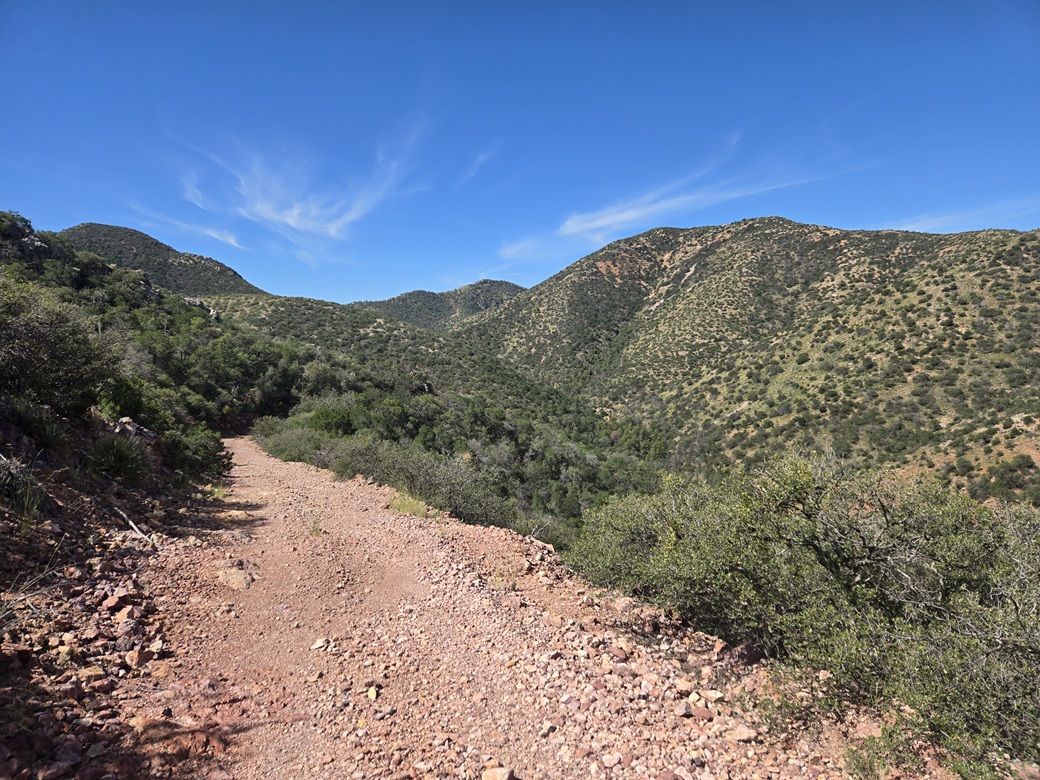
I was in shade for now. It was cool, in the mid 60s., and I made decent time walking up the road. Its condition never got too bad, just steep and sometimes rocky. A larger vehicle should be fine on it, but 4-wheel drive would be recommended.
The road makes two hairpin bends, then achieves a saddle and a fork. I went left, going uphill, circling around to top out on a higher ridge. Here, I could see both peaks across the valley to the west and southwest.
The road then swings south and drops a couple hundred feet. At a lowpoint, another road branches to the right and makes a hard right going north. I got onto this road, which was essentially just the drainage rocks. There was a small flow of water, and I can't imagine a vehicle having been on this road in decades.
This road swings northwesterly around yet another ridge, then comes to another junction. I stayed left, now aiming south again. The map shows a road but in truth there is nothing here resembling a road. At best, some hints of roadbed still exist. Instead, there was a footpath through the grass and brush. Mature trees grew in the old roadbed.
I was hiking this blindly, as I could not see more than fifty feet ahead. It was still shady for now, and pleasantly cool, about 70°. I was tracking myself using my GPS and an online map. I had few visible things to reckon by otherwise.
In time, this "road" began to deteriorate into brush and grass. I was sensing things opening up. I still couldn't see any peaks or ridges, but there was more sun and it didn't feel so claustrophobic.
I essentially guessed as to when to leave the paths and start up the slopes. The first try just dropped me back into the drainage. Finally, I was on a slope that seemed to go up. The GPS confirmed I was approaching a ridge.
The terrain was steep and rubbly, with moderate tree cover (the usual: pine, gambel oak, other oaks, junipers, cactus, agave and plenty of low woody crud), and a lot of grass, most of it about knee high. I would follow a game path briefly, then get tangled in branches. It was impossible to move in a straight line for any distance.
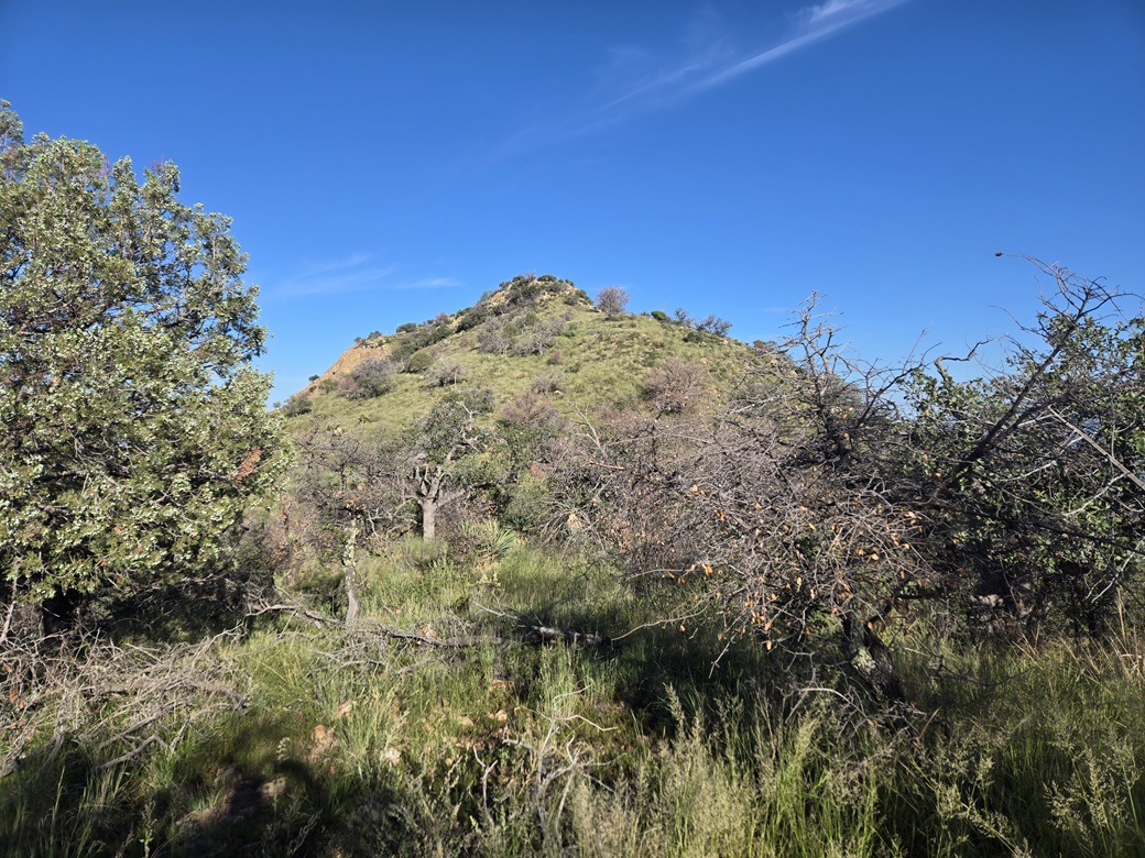
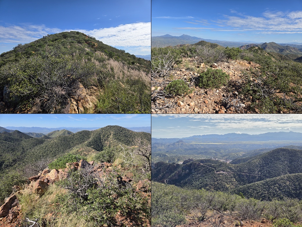
I was finally on the ridge, where things opened up. Now, it was more grass but less trees. I went up toward a false summit, dropped down its other side, and only then had a good view of Threer Benchmark Peak. Other than a couple glimpses from earlier, this was the first time I was viewing it.
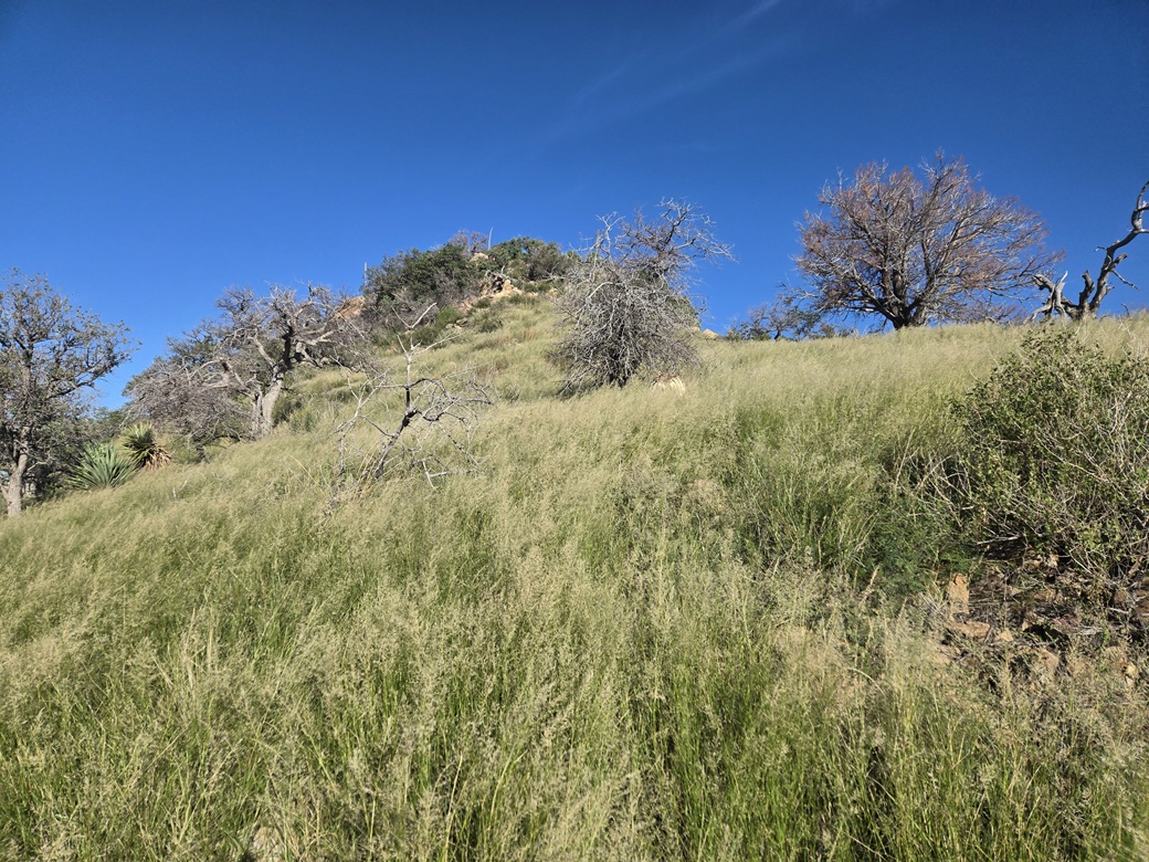
The final climb was up steep grassy slopes. The grass was green and pliant, and got up to my waist. It hid rocks and I needed to step carefully. This was very tiring. And finally, by gum, two hours after starting, I was on top of Threer.
The summit is rocky with grass and low brush. I found the benchmark and shot an image of it. I found a register within a cairn and signed in, the first in a month, but not a popular peak, just a few names going back to 2020.
Views were good. I could make out Mount Washington, Guajalote Peak, other peaks across the valleys, and looking north, the Santa Rita Mountains. It was pleasant up here, sunny and calm. I was beat, though, and probably would have been perfectly happy to just head out now.
This was a hard-earned peak. None of it was difficult. There was no cliffs to scramble or other barriers. But it was slow going, and mostly tedious walking within the trees with no sense of location. The bush-whacking and branch-tangling grew wearisome. However, I was happy, so I had no complaints (yet).
Elevation: 6,349 feet
• Prominence: 392 feet
• Gain: 352 feet
PB
•
LoJ
This peak lies a little under a mile north of Threer Benchmark Peak, only about twenty feet lower in elevation. In a manner of speaking, the two peaks are like twins: similar in elevation, and their prominence figures differ by merely five feet. I was interested in it only for its ranked status.
I was also motivated by the belief that I'd likely never come back for just this one peak. Today was the best chance ever in my life to climb this peak. I really did not want to come back in the future and do battle with the heavy forest and scant tracks down low.
From Threer Benchmark, I descended a little bit, then when I could see the saddle below, dropped north off the peak, easing down the steep grassy slopes to the saddle. This went well, just the usual loose rocks and heavy brush to work through.
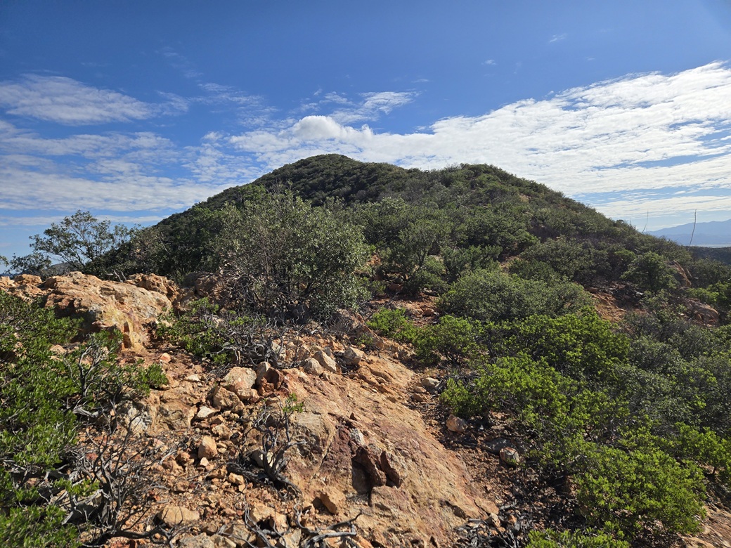
Looking ahead, I could see what was in store: a soft bump up first, then a much rockier bump second, then the crux — a very steep slope up to the highest ridge below Peak 6349's summit.
The terrain was never too bad, but never that great either. Each step had to be taken slowly. Rocks would move, there was brush or branches to deal with, and I was on the constant lookout for snakes and bees. Plus, I was tired.
I walked up the first bump and sidehilled around it with no troubles. Brush would get thick near the tops. Then I dropped a little and aimed for the middle bump with the interesting rocky formations and pillars. These were fun to look at. Getting through these wasn't a problem either. Just slow walking through rocks and brush.
Now I was at the base of the steep slope, about a 200-foot gain to its top. I started up and followed what looked like paths, which got me about half way up. So far, no problem. Then the grade steepened by what felt like 1 degree, just enough to make everything feel a little treacherous.
Instead, I angled right and sidehilled the rest, always going up a little at a time. This actually worked well. I also got some good views of the slopes below me, for when I descended later on.
This segment was slow and methodical, and footing was often loose. I had to cross a couple of bare rocky slopes. Finally, I was on top the high ridge. The summit was just a five-minute walk away.
The final walk was very easy, on what was the most substantial path I'd seen all day. Where did it originate? Was it a crosser and BoPo path? (I had seen some crosser trash in places, most of it old looking). I was on top quickly. I was relieved it was the top, not some optical illusion where I still had another ten minutes to go. It had taken about an hour exactly from Threer's summit to get here.
This peak's summit was a little more bare, just low scrub and rock piles. I felt some rocks slightly offset from the middle were highest. I tagged anything promising, but could not locate a register. This peak sees very few visitors. I'm just the fourth to log an ascent at Lists of John.
The day was still sunny and pleasant, in the mid 70s with a soft breeze. The lack of humidity was most noticeable. I could see the new buildings going up at the Hermosa Mine, and even hear the occasional beep and chirp. I spent about five minutes up here, having an actual break.
Now to start down. I retraced the route back to where I had achieved the ridge, not really eager to deal with those steep slopes again. I just slowly started down and over, following any decent-looking lane I could.
Things got brushy fast, and I was in some heavy, woody brush on very steep slope where the rocks moved with each step. My thinking was if I slipped, I would slide just a few feet into some tangles. About a hundred feet below was a grassy slope. I pushed and battled my way through this crud to the grass. This was very slow, tedious and scratchy, and I was glad to be done with it.
Now on grassy slopes more in the open, I continued downward, sometimes getting back into thickets of brush, not really with a plan other than to drop elevation. Any route down would place me into the main canyon.
After a few more minutes, I dropped into a drainage, now in the trees again. I kept going down, meeting up with larger drainages until I was back to the "road". I even recognized a few features here such as trees across the path. I was relieved to be off those steep slopes.
I still had some miles to walk. I just walked, being careful and minding my steps. I retraced my route until I was back to the main road at that lowpoint I mentioned earlier. Now I was back on "good" road and I took a longer break here. I was still looking at having to regain almost 300 feet still.
I slowly walked up those 300 feet, then had a fun steady walk downhill to my car. I got a good elevated view of the buildings under construction at the mine. They have huge heavy equipment there. Some of these buildings look to be four or five stories high. I'm not sure how access to these peaks or the general area will be affected. So far, one may pass through the main mine area without problem. I think it will stay that way since that's the only way down to points south like Washington Camp and Lochiel.
I was back to my car just shy of 11 a.m., a 4-hour and about 40-minute hike. I was beat, but pleased how things went. I was glad to get both peaks. It means those lower roads will never see the soles of my feet again. There was never any scary show-stopper segments, but the travel was slow due to the rocks, brush, grass and steep slopes.
I quickly changed and drove out, stopping briefly in Sierra Vista, before heading home to Bisbee.
|




|