
The Mountains of Arizona
www.surgent.net |
|
Peak 3582 • Black Mountain • Peak 4029 • Peak 5235 Today's adventure would encompass four peaks spread around the upper Tonto Basin and the lower Mogollon Rim foothills. None of these peaks would be long hikes, but cumulatively, they would make for a full day's outing. Black Mountain is the main "peak" in this area, a dome of volcanic cliffs and rocks that rises above the canyons and ridges that feed into Tonto Basin. The other three peaks are barely peaks, being very broad gentle mounds that barely squeak above the 300-foot prominence barrier. In fact, two of the peaks, Peak 4029 and Peak 5235, are newly discovered ranked peaks, using the 1-meter Lidar data. I noticed Peak 4029 suddenly listed, and this got me thinking about spending a day in the area. I went onto the Lidar sites and checked out a couple more peaks that heretofore had been barely below the 300-foot barrier. I found another one, Peak 5235, that had been listed at 290 feet of prominence but was actually 302 feet. After teaching my class Tuesday, I got groceries and headed up the Beeline Highway (AZ-87) up and over the pass at Mount Ord. I drove down into the Tonto Basin, then pulled into the Barnhart Trail Road, the one that leads in toward Mazatzal Peak. I got in about a mile and found a clearing no one was using, and set myself up for the night. It was about 9:30 p.m. when I rolled in. Tonight's moon was a waxing crescent, almost at half stage. It was already up and would set about at 1 a.m.. The sky was clear, and the moon lit up the place nicely. I did not need a flashlight to get around. I had something to eat, then wandered around the area. I set up my cot and crawled in about 11 p.m.. It was a mild night, in the low 50s for now, expected lows in the high 30s. For February at this location, that's about ten degrees above normal. I enjoyed staring at the moon and the stars.
Date: February 5, 2025
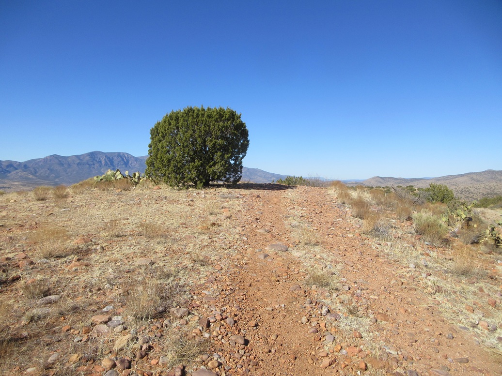
• Elevation: 3,582 feet
• Prominence: 322 feet
• Distance: 2 miles
• Time: 90 minutes
• Gain: 822 feet
• Conditions: Sunny and cool
Arizona
•
Main
•
PB
•
LoJ
I was up at dawn this morning. It was cold but not uncomfortable. I took down my meager camp then sat in my car's front seat, facing east toward the sun, and let things warm up.
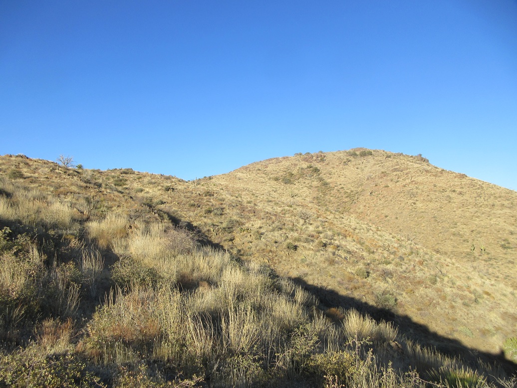
I was parked directly west of Black Mountain, but my plan was to head south a couple miles and hike Peak 3582 first, then work my way north. Peak 3582 is one of three peaks in a clump of hills that straddle Gold Creek. I had hiked the other two hilltops five years ago.
This peak is best accessed from the east off of state route AZ-188. I drove through the community of Jakes Corner, then where the road bent south, parked somewhere near its apex. I was careful to ensure I was on Tonto Forest land, not someone's private property. I was about a half mile south of the last buildings in Jakes Corner.
Peak 3582 rises about a mile west, about 800 feet higher. It would be my biggest hike of the four peaks, and I wanted to do it first. I crossed the road and got onto the slopes, immediately stopped by a fence. I walked beside the fence a few yards and crossed it at a culvert. There were no signs on the fence.
I then started walking uphill toward the peak. Its main summit mass could easiuly be seen, but the highpoint was hidden for the time being. I walked through low grass, scattered brush and low trees, and cow poos. I saw a couple of the beasts well off to the side. They had knocked in paths and I followed these paths whenever I could.
I gained up a steep slope to a hilltop, the dropped about 40 feet down to a saddle. The next slope was also steep and rockier, but I found a cow-path that seemed to weave through the rocks. How they knew which way to go impressed me. This put me on a higher saddle and ridge, the summit mass directly above.
The final limb was like before, steep but easy and quick, with cow paths helping. I was now on "top", but the top was a long ridge and the actual highpoint was not obvious. I was on the ridge's north end, whereas the map has a spot elevation at its south end.
I walked to some rock outcrops and tagged them, plus snapping some photos. Then I walked the ridge to the south end and the presumptive highpoint. I found a small rise and a rock outcrop with a cairn and register. I signed in. Not many people come to this peak. Looking back to the north, it felt a few feet higher here, but I had covered all bets anyway by tagging all possible contenders.
It was cool but warming, into the 40s at the momemt, and very sunny. I never really stopped, but I would walk around slowly and look around, taking my time. I spent about ten minutes on this top ridge.
Going down, I retraced my route almost exactly, following the cow paths and even my own bootprints. The outbound hike went fast, and I was back to my car after 90 minutes. This had been a nice short energetic hike, and the cow paths made the ascent significantly easier.
Elevation: 3,971 feet
• Prominence: 295 feet ✳
• Distance: 2 miles
• Time: 75 minutes
• Gain: 600 feet
• Conditions: Sunny and pleasant
PB
•
LoJ
•
Lidar
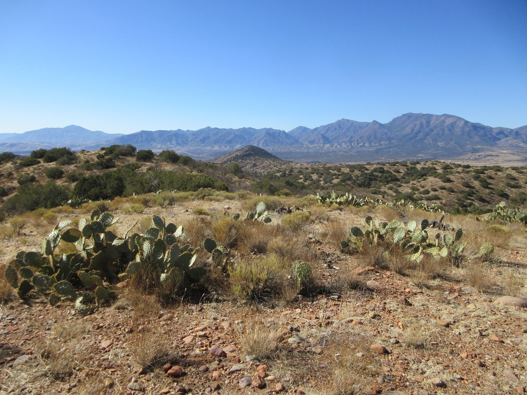
Back at the car, I drove back up AZ-188 to the Beeline (AZ-87) and north on that a few miles to the Gisela Road turnoff, heading east. Black Mountain rises above these hills, which form a bulwark between Tonto Creek to the east and the many lesser washes coming in from the west, all feeding into Tonto Creek. Gisela is a little town along the Tonto Creek banks.
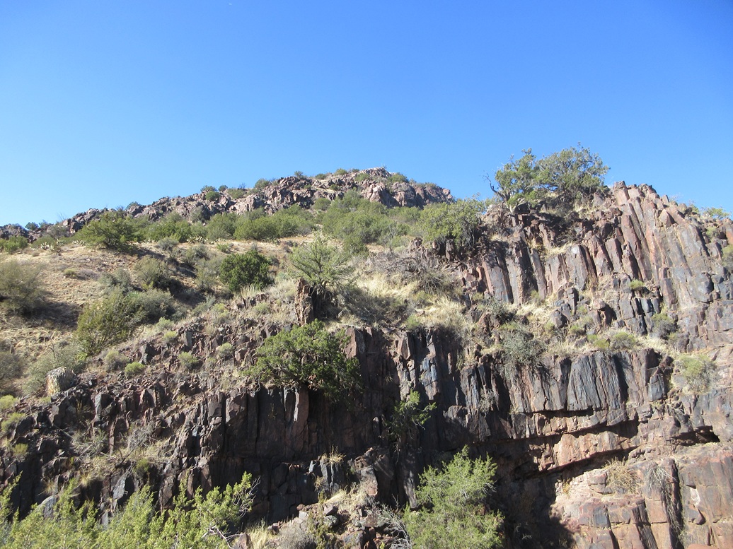
Black Mountain is a singular peak rising above these hills and ridges, easily visible from miles around. I parked in a tiny pullout slightly southeast of the peak, where a dirt track drops into a drainage and heads north, toward Black Mountain Tank.
I chose to approach this peak from the north, so I walked in on this track, through two wire-stick gates, past the tank itself, and following an eroded track up to the ridge north of the peak. From this side, the peak has many cliffs and I wondered if I had made a stupid decision to come this way.
On the ridge, I walked the tracks until they ended at the base of the peak itself, walking past a couple cows who just watched me walk by. I started up the steep slopes, hoping they would go. The cliffs up close were broken with many intervening slopes of loose rock and brush.
I was able to get up the slope, but more than once rocks would roll from under me and I'd slip back a couple feet. It wasn't fun. Up ahead were more rocks, and rather than find a walk-around, I just scampered up one easy chute. Now I was above the cliffs and rocks and on the home stretch.
The final segment gained about another 75 feet but was gently-sloping terrain with plenty of large volcanic rocks laying about. Soon, I was on top.
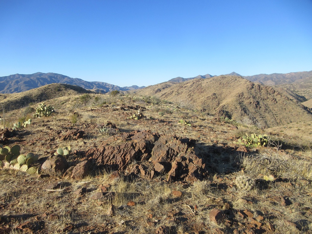
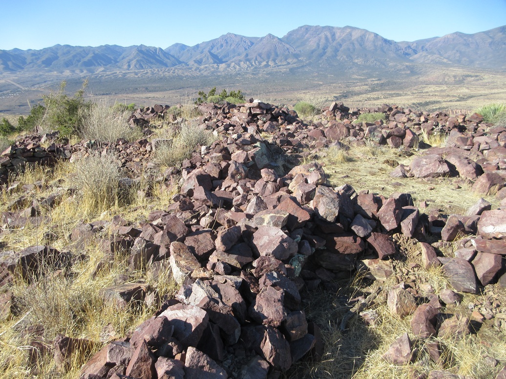
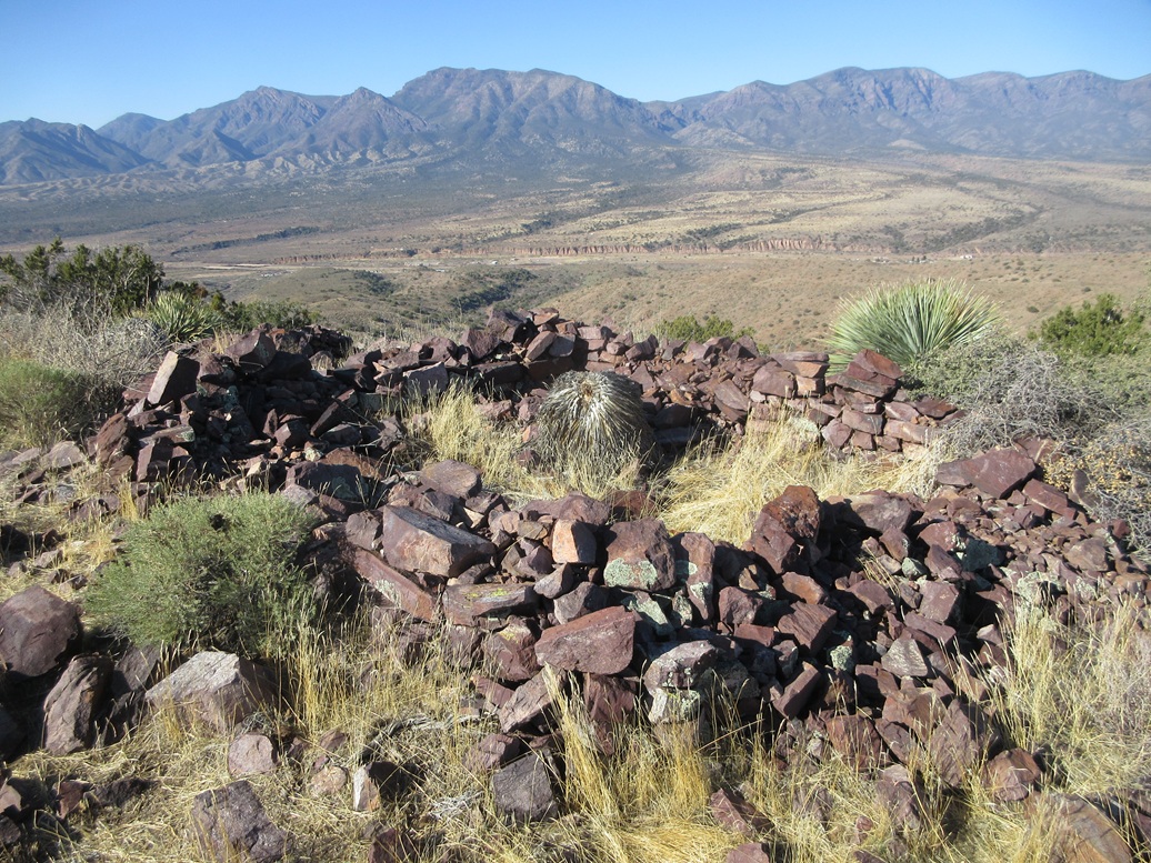
The summit was once home to an ancient Indian band who built walls from the rocks to create living quarters. These ruins date back about 700 years, so I have read. There were easily a dozen rooms, and the walls were up to three feet high in places. This would have been an ideal spot to build a small village, with the elevated views to help keep an eye out for invaders.
Of course, I knew none of this beforehand, and just happened to discover it myself for the first time. I stuck around for about fifteen minutes, checking out the walls and rooms, giving the whole area a good walk. It is fascinating to consider that there was a small village up here ages ago, and the walls still stand all these years later.
I descended the same way. Later, looking at tracks of what others have done, most tackle the peak directly from the south via the main road. It looks steep and in retrospect, probably was a smarter idea than they way I went. I stopped briefly to check out the small masonry dam built in the canyon to hem in Black Mountain Tank. I wonder if this wall will still be standing 700 years from now, in 2725.
I enjoyed this peak a lot and the unexpected (for me) ruins. I read up on them after I was down. I always enjoy some random archaeology. The round trip took me just over an hour. It was still late morning and warming, although still pleasant.
In studying the Lidar data for the peaks in the region, this peak, which had been listed as a ranked peak with 311 feet of prominence, actually got demoted, as the 1-meter Lidar gives a prominence of 295 feet for the peak.
Elevation: 4,029 feet
• Prominence: 312 feet ✳
• Distance: 1.8 mile
• Time: 50 minutes
• Gain: 550 feet
• Conditions: Sunny and still very nice
PB
•
LoJ
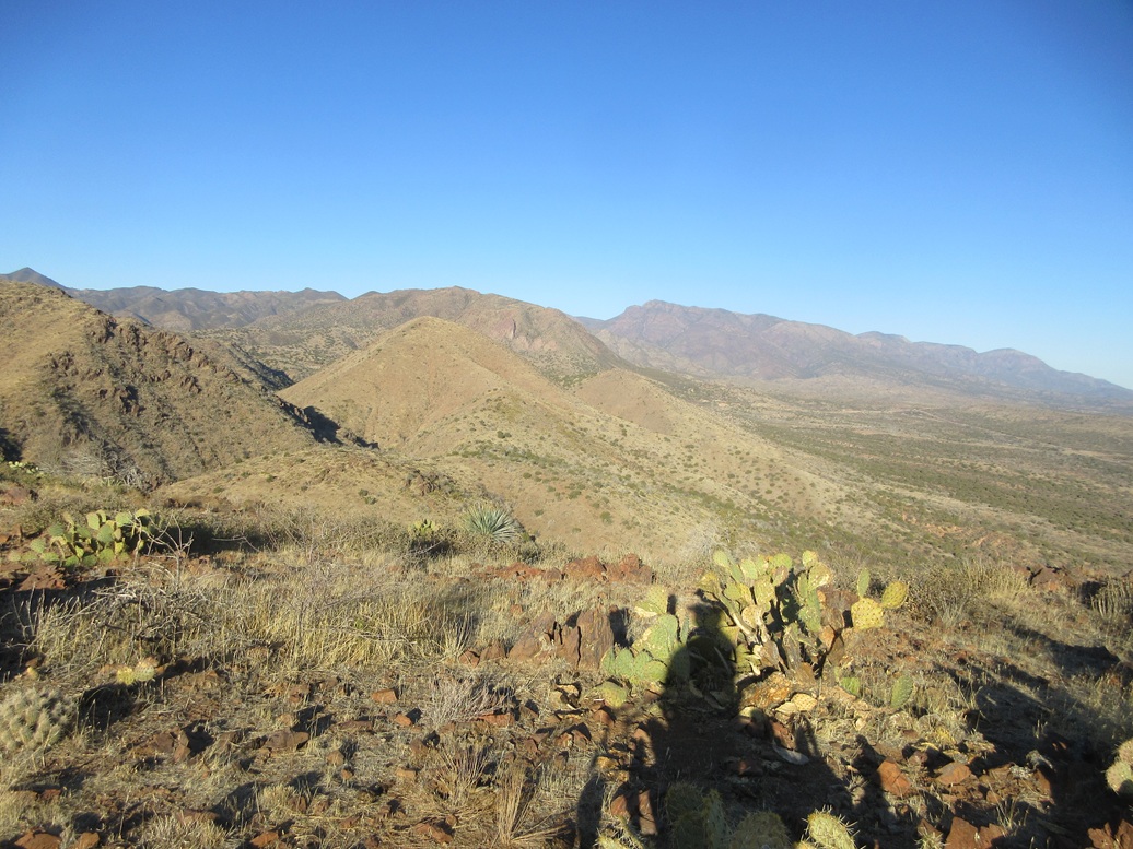
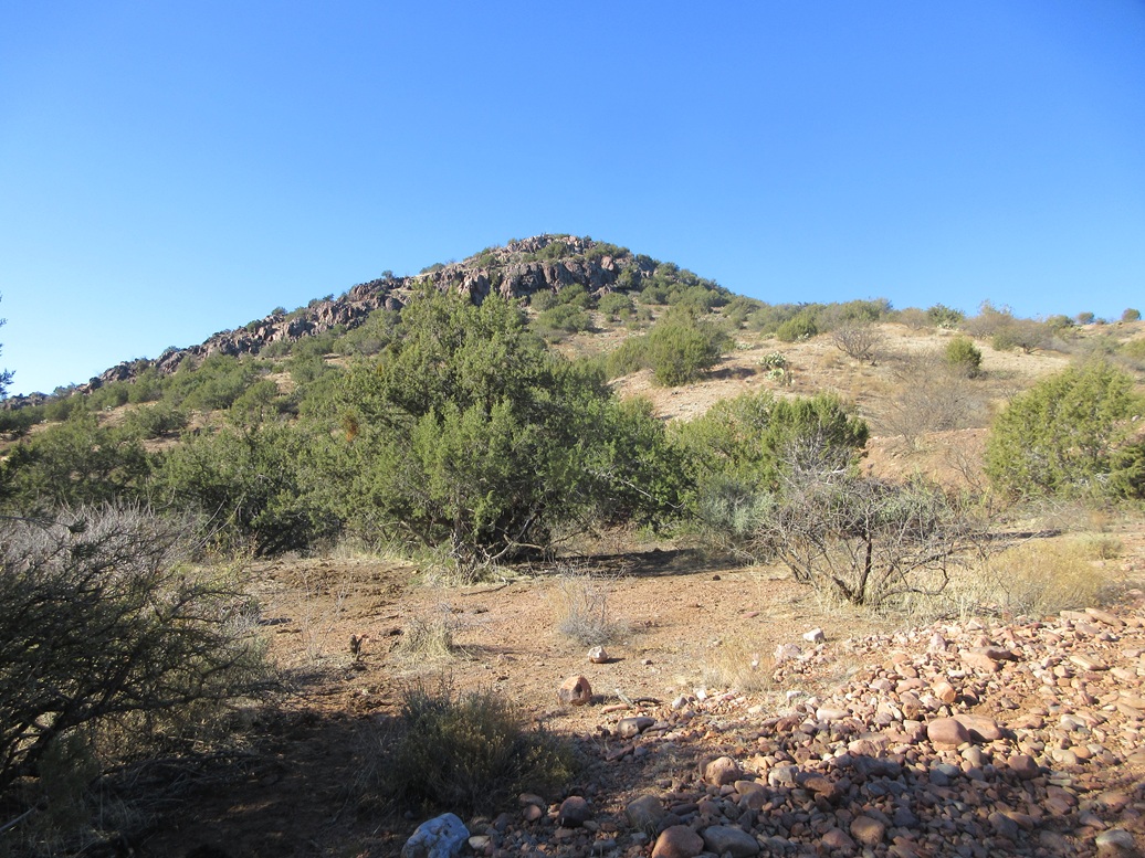
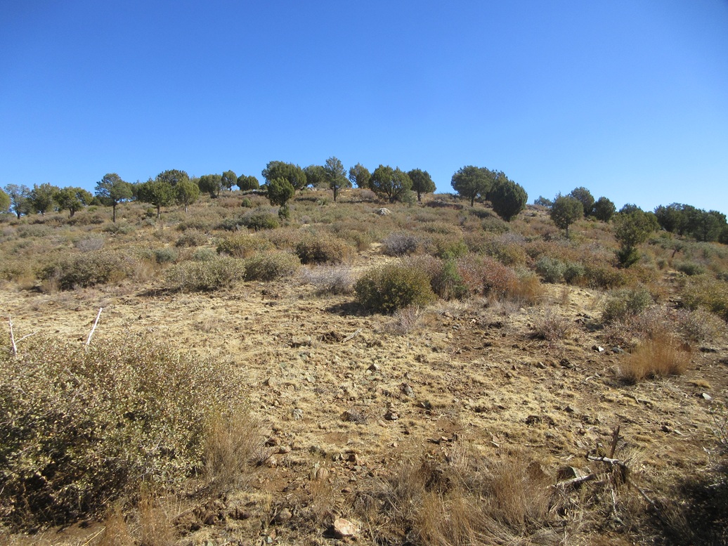
This peak rises about a mile northeast of Black Mountain, in the same hill and ridge system. It was just discovered in the last month to be a ranked peak. Its previous prominence was about 265 feet, but suddenly gained almost 60 extra feet in prominence using the 1-meter Lidar data.
I drove east up Gisela Road, going steeply uphill to a pass, then steeply downhill, and over-running the dirt track I wanted for the hike. I turned around and drove back, slightly annoyed at the amount of traffic on this road. I wanted to go slow and be sure I knew where I was and did not want various work trucks on my bumper. I was able to squeeze my car onto a dirt pullout barely wide enough to keep it off the highway.
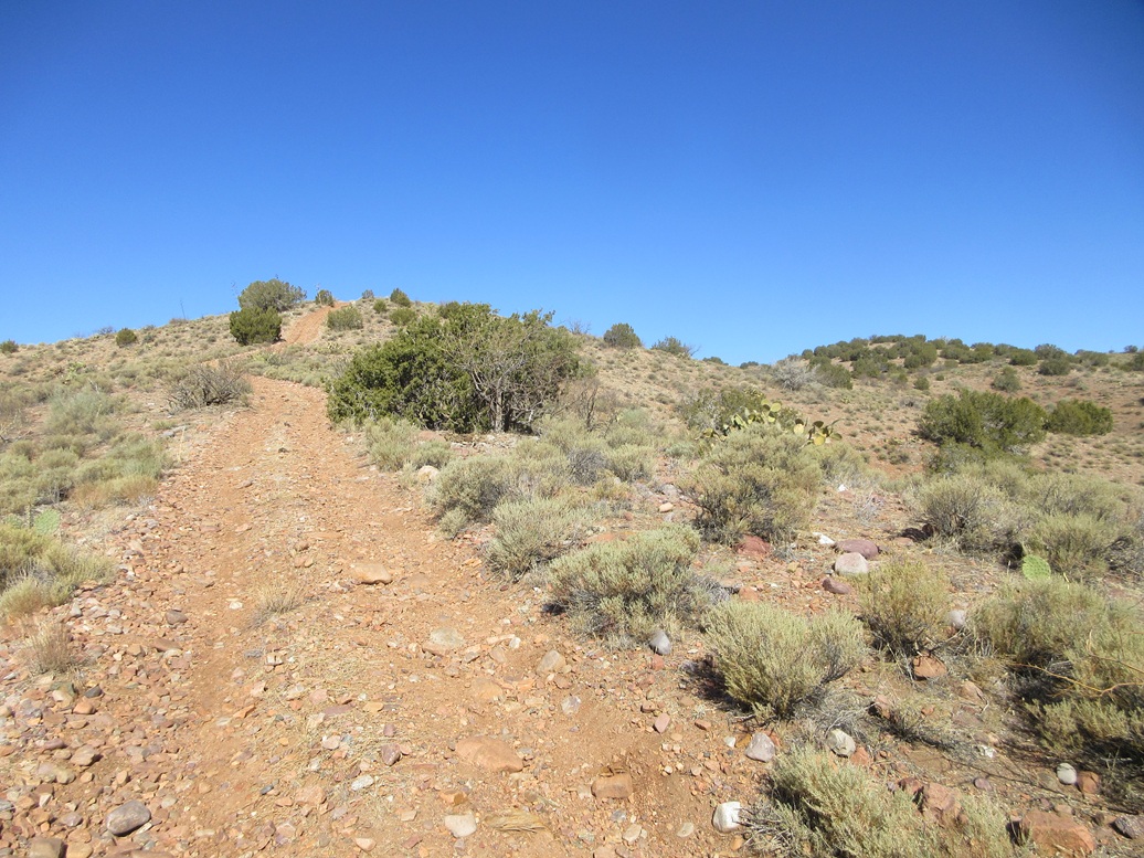
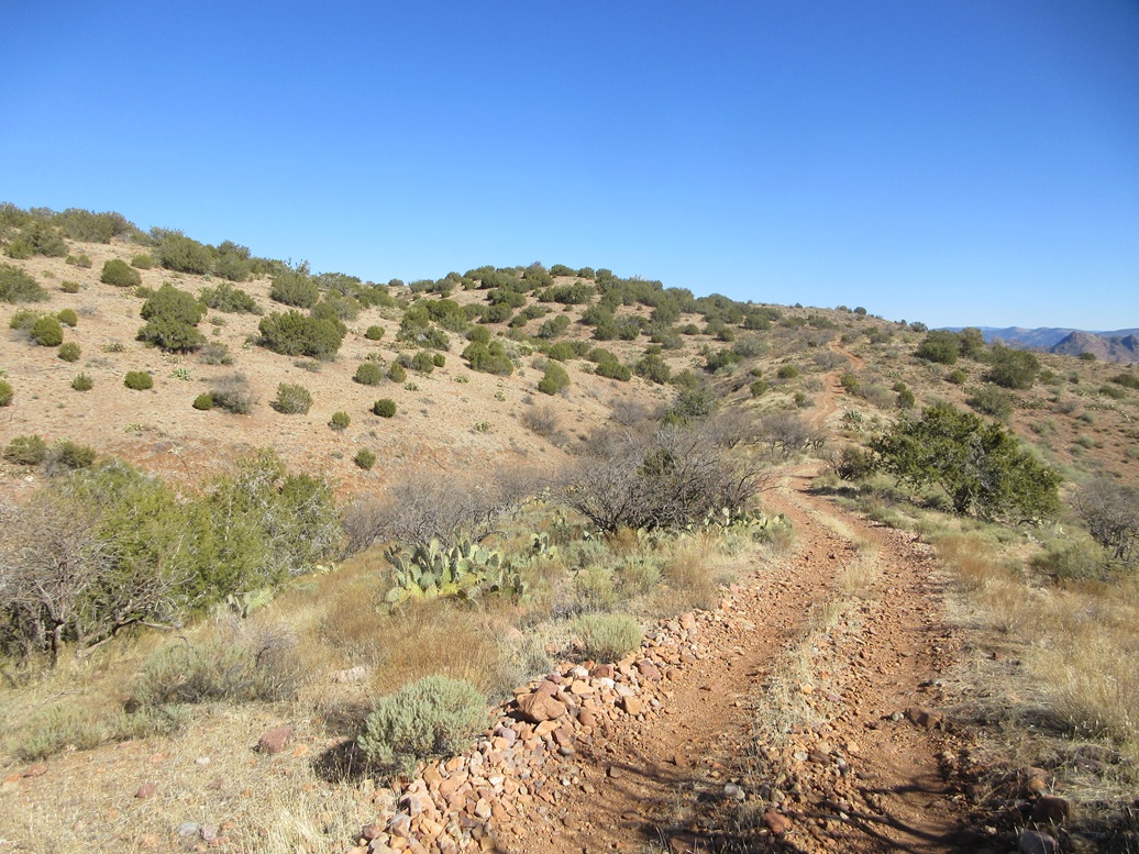
This would be an easy peak, following a dirt track all the way up. I started walking, the track very steep at first, gaining about 75% of the elevation in the first half mile. The track was rocky and eroded and it was often easier to walk on the slopes beside the track.
Once on the ridge, the grade lessened and became more level, even dropping about twenty feet in one spot. The track then gained steeply up the next hill. I was essentially here. One bump seemed to be highest so I stomped on it. Another one slightly northwest with a lone tree on its top seemed as high, so I went there too.
I sat for a spell and enjoyed the solitude, the weather and the views. This was an easy peak, nothing special, but the views from up top were very good. I was tired by now, having gained almost 1,900 feet on my three hikes so far.
The downhill hike went fast, just being sure not to slip. I was back to my car in less than an hour. This wasn't a memorable peak, but it is easy to do with good views, so it has that going for it.
Elevation: 5,235 feet ✳
• Prominence: 302 feet ✳
• Distance: 1.6 mile
• Time: 45 minutes
• Gain: 258 feet
• Conditions: Calm and lovely
PB
•
LoJ
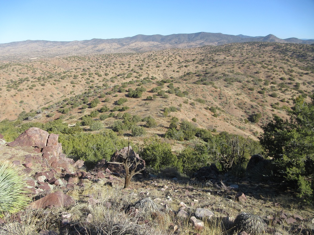
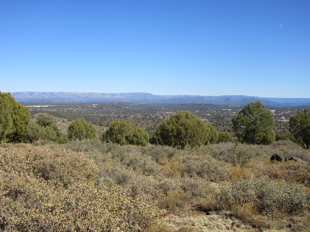
This peak is higher up in elevation, in the hills to the southwest of Payson. Back on the Beeline Highway, I had about 15 miles of driving to get me into Payson.
In town, I went left on Main Street, and followed that past the park and pond (and ducks), past the Country Club, past some city buildings and where the pavement ends, the road now called Doll Baby Road. This road is unpaved for about a mile and crosses a stream twice. Then it is paved again as it gains steeply (over 10% grade) to an apex west of the peak. I parked in a dirt clearing to the side of the road.
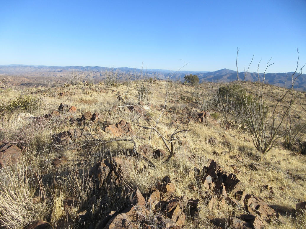
Playing with the Lidar sites beforehand, I took a look at the half-dozen peaks and hills in and around Payson that had been close to the 300-foot threshold. This one had been listed at 290 feet of prominence, but it ended up being 302 feet. I had John at Lists of John confirm it and he did, updating his site accordingly. What was interesting is that the other "too close to call" peaks in the area were all significantly lower in prominence once I looked at the 1-meter Lidar. This was the only one to get promoted.
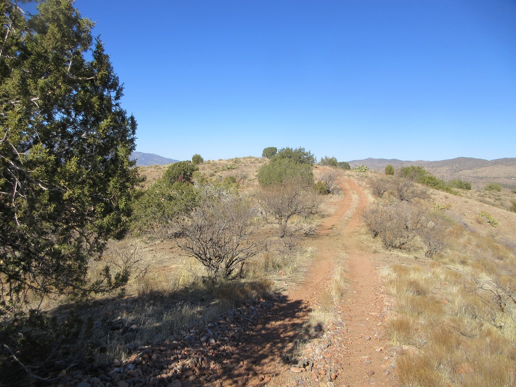
This would be the shortest and easiest hike of the day, which was fine with me as I was tired by now. I walked up a steep embankment and onto the open forest terrain, the trees here mainly piñon and juniper and some oaks, but very spread out and very little undergrowth. Navigation was trivial.
The route follows an arc heading east then southeast to the highest ground. Along the way I met another hiker who was just relaxing in the shade of a tree. I was on top this humble peak after about 20 minutes, the one-way hike less than a mile.
The top was broad and rounded, but locating the highest point was easy. There was a rock outcrop at the highpoint, and the ground dropped gently in all directions so there was no doubt. There was no cairn or register, not that I expected to find one for a peak that had been an offically-ranked peak for about two days now.
I did not linger. I turned around and headed out, back to my car quickly, the total time gone about 45 minutes. I was beat by now. It was early afternoon, about 1:30 p.m.. I drove back into Payson but did not stop, instead continuing southbound all the way back into the big city.
I was pleased with today's haul and enjoyed the hikes, the scenery and the old stone walls and ruins. My total statistics were over 7 miles of hiking with over 2,000 feet of elevation gain.
This week was the big golf tournament in Scottsdale. When we lived in Scottsdale, they'd shut down streets all around the golf course. The number of drunks was incredible. They'd be passed out on the side of the road. I did not like it one bit, and nothing impresses me less than a grown man drunk off his ass thinking he's funny.
I had a hotel in south Scottsdale, a Motel 6, because every other hotel in town was booked for the golf tournament. This Motel 6 usually is okay, barely, but the last couple times I have been there, things have not worked. So I got checked in only to discover there is no water. The plumbers are working it it, they told me, no timeline though. So I said fine, give me my money back, so they did.
I have a couple other places I usually stay. One was booked solid. I got on my device and looked at the other one. Against my better judgement, I used one of those aggregate booking sites to book a room instead of going to the hotel's site directly. The cost would not have been any different. I was happy just to get a room.
So that night I get an email telling me about the cancellation insurance I had purchased. The hell I did. It was just $17.09, but I did not purchase it. I know what happened: it was probably pre-checked and I did not see it or notice it, so I bought it accidentally. This pissed me off.
I was able to get it refunded after a couple days, so thanks to the booking site for doing that. But I hate these damn hidden underhanded tricks, to where every transaction these days feels like I'm being conned in some manner. I won't use that aggregator site again. I find these tactics to be disingenuous. Legal, but sneaky.
|


|