
The Mountains of Arizona
• www.surgent.net
|
| Peak 5560 • Texas Canyon |
• Texas Canyon • Little Dragoon Mountains • Cochise County |
|
Date: April 6, 2025
• Elevation: 5,560 feet
• Prominence: 360 feet
• Distance: 2.5 miles
• Time: 1 hour, 40 minutes
• Gain: 670 feet
• Conditions: Sunny and clear, very pleasant
Arizona
•
Main
•
PB
•
LoJ
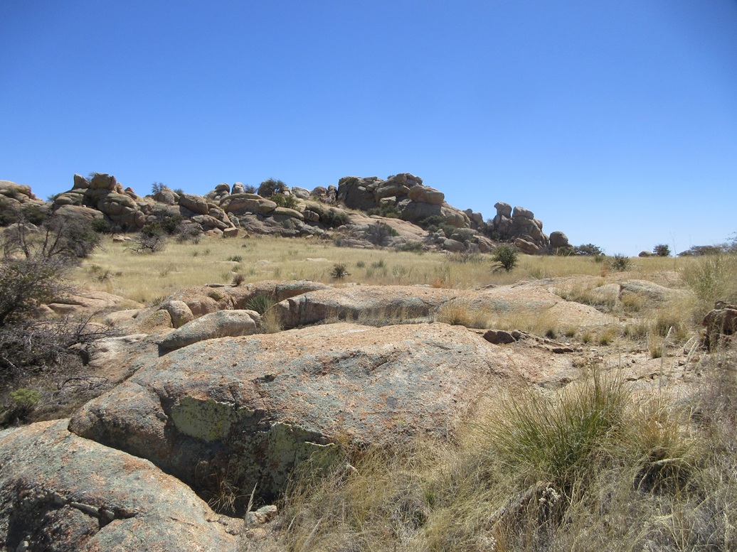
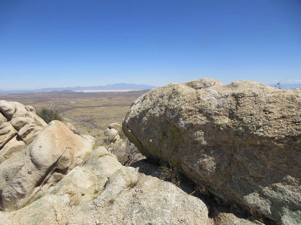
This rocky peak rises immediately north of the rest area along Interstate-10 within Texas Canyon, about 20 miles east of Benson. The peak is basically a pile of massive boulders, with some brushy slopes and trees in between. From the rest area side (the south), it looks like nothing but cliffs. However, there are ramps and chutes around back that make an ascent relatively simple.
I had just hiked the Fisher Hills Highpoint earlier today and was still feeling up for more adventures. I've given this peak some consideration in recent months but always passed on it, usually tired out from some earlier bigger hike. The last time I was here was in February, after we all climbed Adams Peak. Matthias and I were going to climb this peak, but I backed out at the last minute. Matthias did it solo, and it was his GPS trace that I would follow.
On another trip a few months earlier, after climbing in the Gunnison Hills, I took a look at its approach from the rest area itself. The rest area is fenced, and it is substantial fencing, not easily breached or crossed. There was one let-in point, a gully choked with trash, but I did not like this option and bailed. So this was my third time back.
Matthias had come in from the east at the Johnson Road Exit (home of The Thing?). I exited and went north onto gravel Adams Ranch Road. This is a good road. It bent west then southwest. At the Walker Ranch Road, I went in a little more to a cemetery, parking discreetly off to the side. I was less than a mile from the summit.
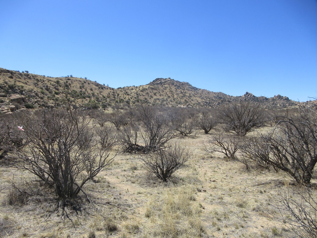
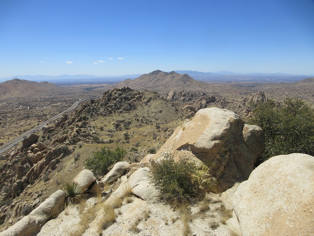
From this side, the rocks are still abundant, but there are more slopes of grass and trees to consider for a route. It looked straightforward: get up onto the eastern ridge, then follow that up to the rocky summit, then hope I get lucky with the rocks at the very top.
I started hiking at 11:20 a.m., the day sunny and still cool, now in the high 50s. From the cemetery, I followed cow paths south through scattered mesquite trees to a fence line. I crossed it by stepping over it. A minute or two later, I was at the base of the slopes leading up to the ridge.
The hike up to the ridge was a little steep and loose in places, but easy overall. I followed cow paths whenever possible. I gained about 250 feet to place myself on the ridge. Cattle get up here, as their poos attest.
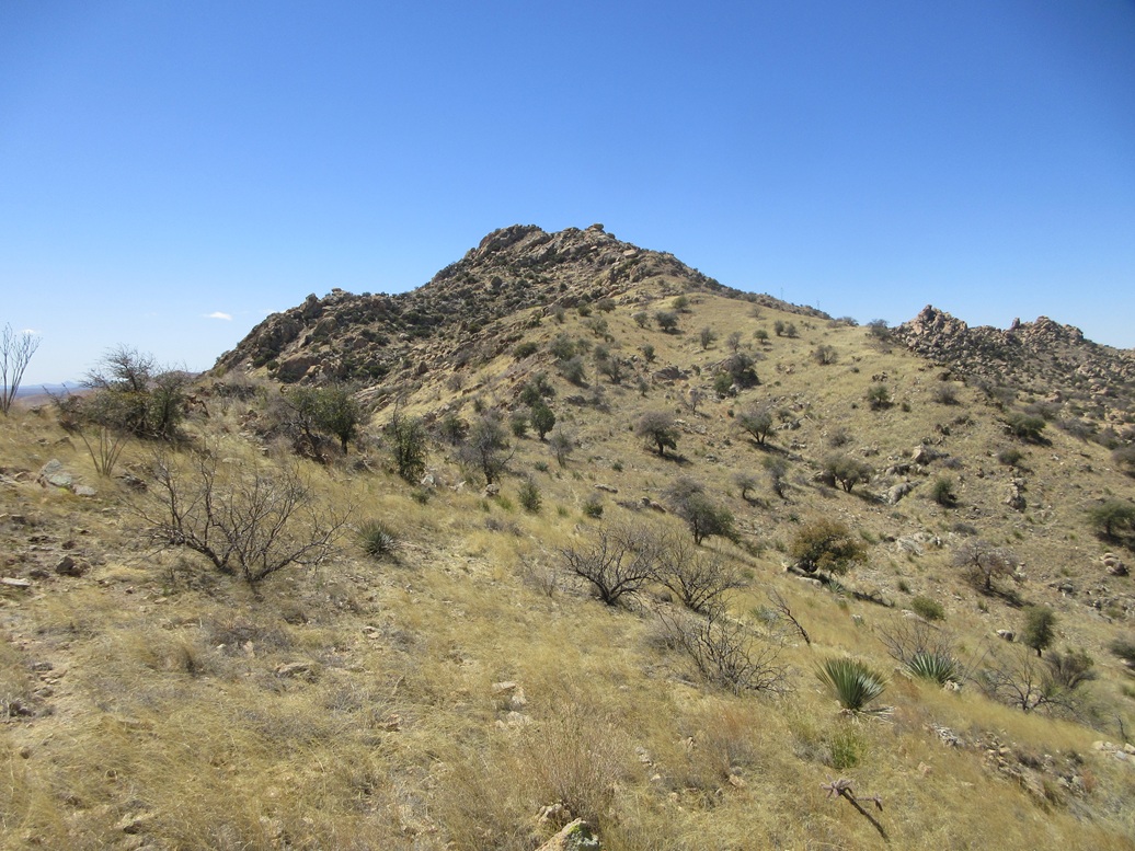
I then turned right and aimed for the peak. Between me and it was a couple more ridge bumps. The going was easy, with lanes and trails to follow, most of them cow trails. I encountered some mine tailings and actual mine shafts and trench pits. These were probably dug out a hundred years ago, and the rocks on the tailing slopes have never consolidated, being as loose as ever.
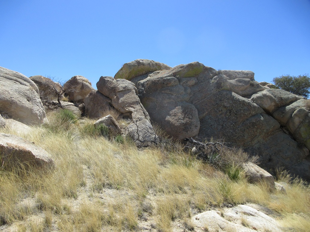
A couple more slopes like this, and I was now at essentially the base of the summit rockpile. A direct assault was out of the question. Instead, there was a ramp offset to the north that angled upward around these rocks. The ramp itself was messy, steep, brushy and with rocky tiers to get up, but it was safe and protected too. This angled up and to the left. I then clambered over some open rock to gain the summit area.
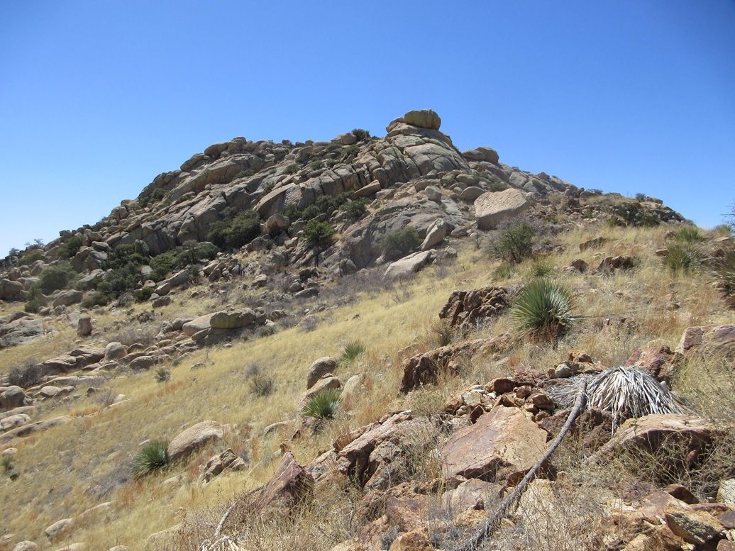
The summit features a lovely flat grass meadow ringed by the big rocks. The highpoint rock was plainly obvious by now. I walked across the meadow, then up more rock and up grassy slopes, now at the base of the summit rocks.
I followed what looked like the smartest route, which approaches the top rock from the east (climber's left). It was an easy matter to scamper up through the lower rocks, placing myself literally ten feet below the top rock.
This would require a scramble. Two options presented themselves and neither looked that good. I'd rate both as Class-3, but one was above a cleft and another above a long run-out. Should I fall, I'd be in big trouble. Without a spotter, I backed off, and decided to take a look around the other side.
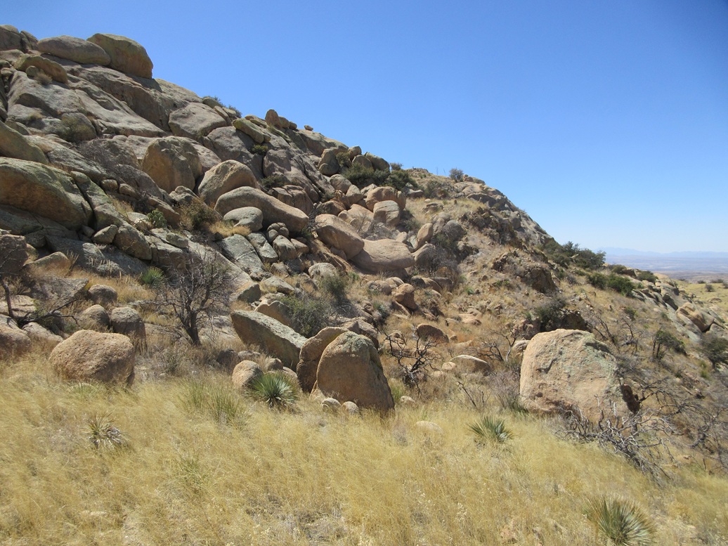
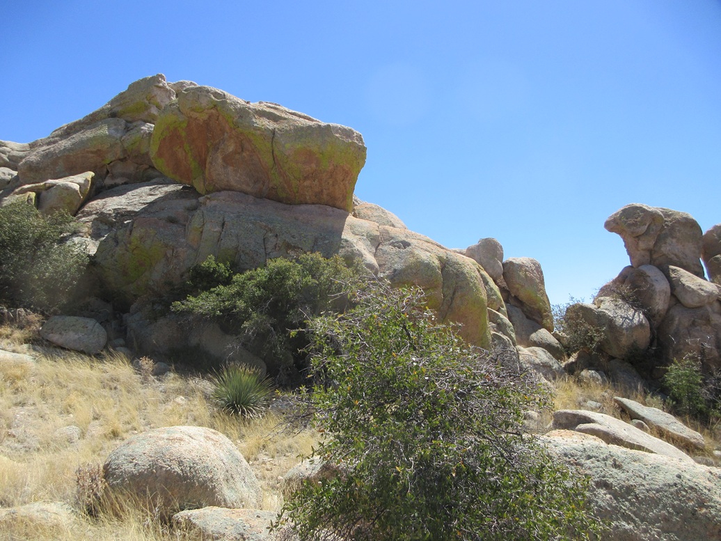
I wasn't encouraged that things would be better from the west side. I descended off the rocks and downslope, losing about thirty feet. There is an obvious notch in these summit rocks (see my image). This is where I went.
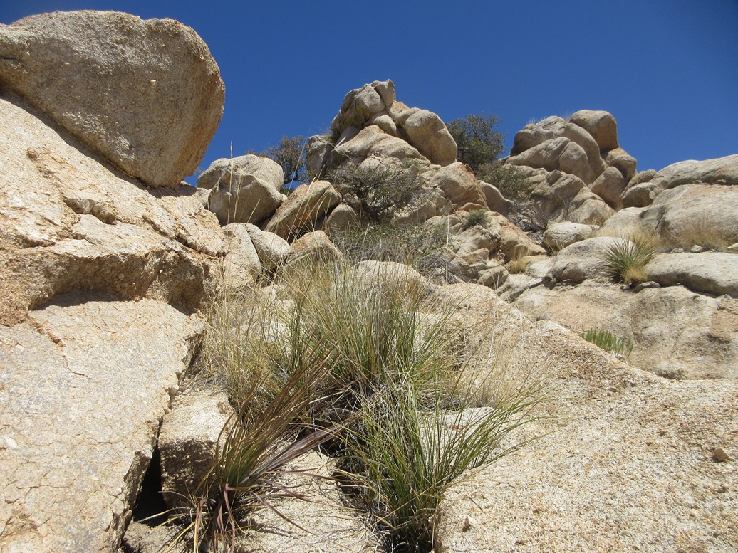
The rocks get a little tight here but I was able to squeeze and sidle in. When things opened up again, suddenly I saw a lovely rocky chute to my left, directly up to the summit. The first move was the trickiest but not difficult, just a matter to ensure good footing and trust the friction. Once on the rock itself and within the chute, I ambled up and to the right toward a lowpoint. This fed me onto a ledge which was wide and safe, and the summit rock was directly ahead, and easy twenty-foot walk away.
I hustled to the top, leaned in and slapped the highpoint. The summit rock itself is a big egg-shaped thing, about four feet high relative to the rock beneath it and where I stood. I was delighted and a little surprised how easy this secondary option worked out. I had expected more cliffs and awkward chutes.
I did not linger. I snapped a couple photos and made a cursory look for the register, but did not locate it. I wanted to scamper down the rocks while I remembered what I did. Going down went very well, gravity and my long legs helping. I would not rate any move within this chute above Class-2, maybe 2+ in one or two spots. It was all protected with good friction. One or two spots would be "no fall" zones. Attention is a must.
The climb had taken a little less than an hour. I was ready for a break, but I decided to get down a little more, at least below the ramp I mentioned earlier, to where I did not need to worry about rocks any more. This I did, taking a break once back on the grassy slopes.
The rest of the hike out went well, following cow and human lanes, and letting gravity assist. As a result, the outbound hike took just 40 minutes and went without a single issue. I was back to my car at 1 p.m., now officially tired but very pleased how well this hike had gone.
This peak rises above the Texas Canyon, a small region within these Little Dragoon Mountains noted for its many interesting rock spires and formations. Most people just drive on through. Recently, some land to the south has been opened up for hiking. None of these trails go up any peaks, but given that the land had been private (it still is) with no public access for the better part of a century, this development is most welcome.
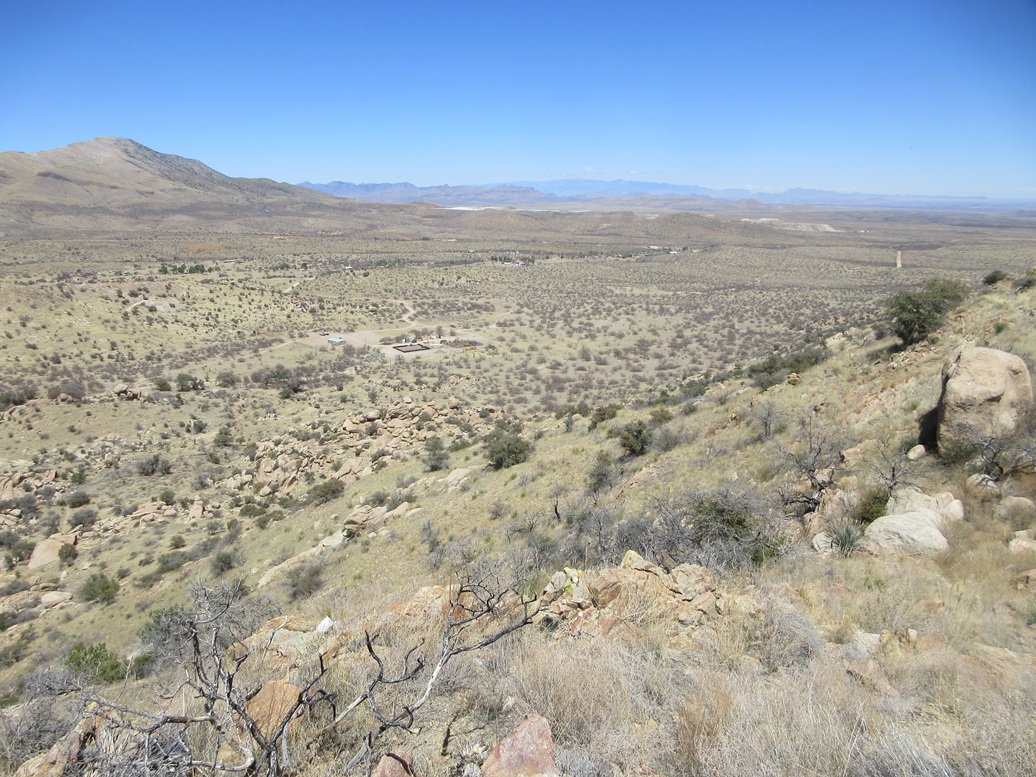
Me, I wanted to head home. I got onto southbound US-191. I took a look at a pair of peaks near Pearce, the old mining town and today a near-ghost town. These peaks lie on public (BLM) land, but are surrounded by private lands and homesteads. As a result, I did not see any easy bypass options and decided to just continue on home.
|

|