The Mountains of Arizona
www.surgent.net |
|
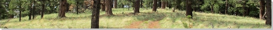
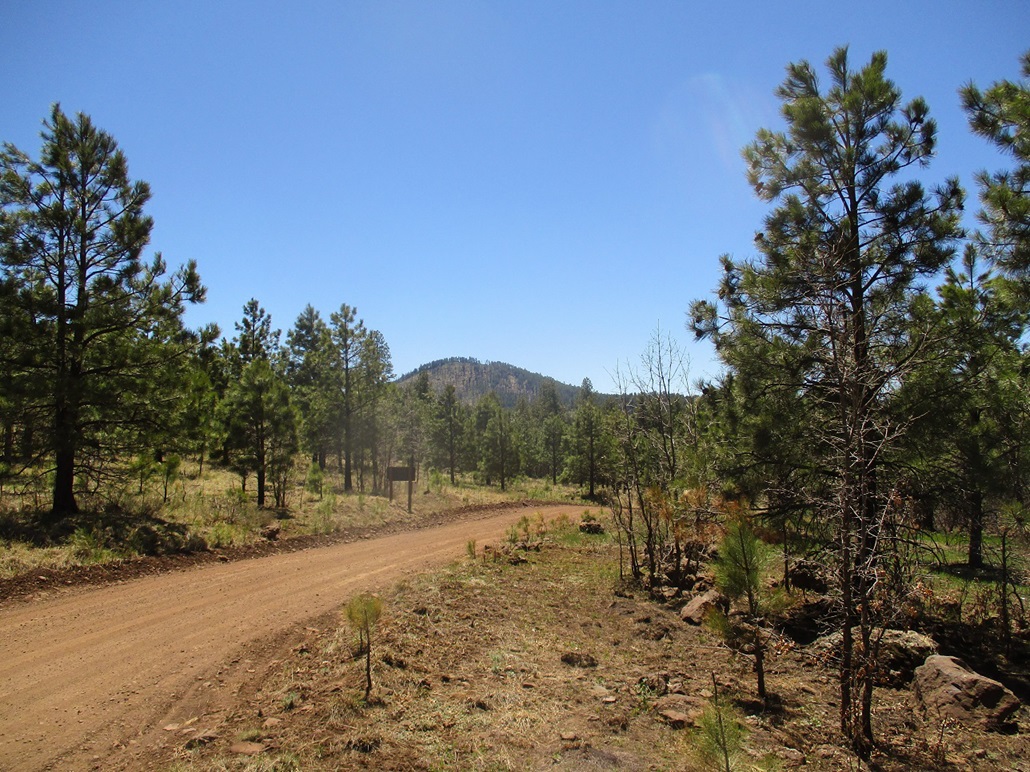
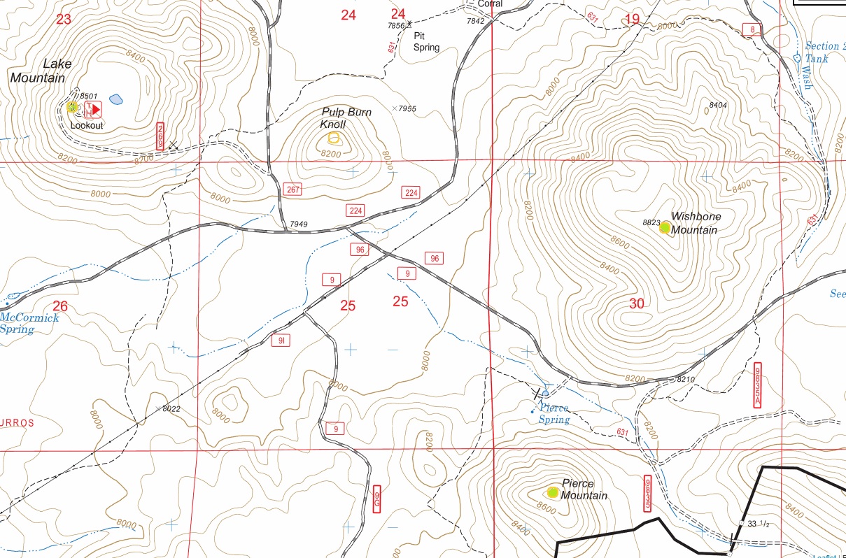
Wishbone Mountain • Pierce Mountain • Lake Mountain This was my third time in three weeks visiting the hills east of Show Low. The weather is sunny, warm and stable, and conditions are perfect at these elevations. There is no shortage of hills to hike, so today, I would concentrate on a clump of forested hills along Forest Road 224 near the Lake Mountain lookout. I left home early and was in Show Low about 7:30, then onto FR-224 (from US-60), heading southbound. I had maps for about eight other hills along the way but was mainly inspecting roads for now, getting ideas for later trips. About 8 miles from US-60, FR-224 enters into a valley hemmed in by Wishbone Mountain on the east, and Lake Mountain on the west.
Date: May 3, 2020
• Elevation: 8,823 feet
• Prominence: 523 feet
• Distance: 1 mile
• Time: 40 minutes
• Gain: 540 feet
• Conditions: Sunny and warm
Arizona
•
Main
•
PB
•
LoJ
•
Interactive map
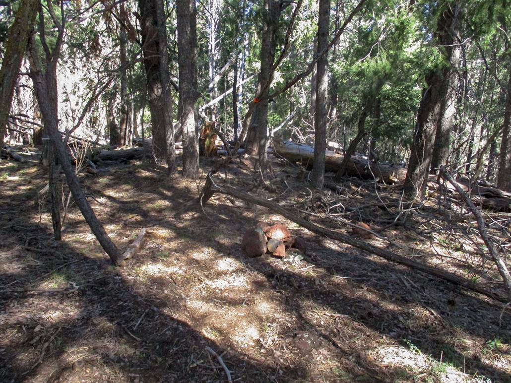
Wishbone Mountain is big, mostly symmetrical, and heavily forested. I could climb it from any direction. I chose to drive a lesser track (FR-96) around its south and east sides to where it tops out at a low saddle near a let-in point for Trail 631, which wanders all over the place. This is the Los Burros Trail, part of the extensive White Mountain Trail System.
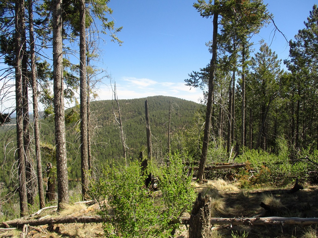
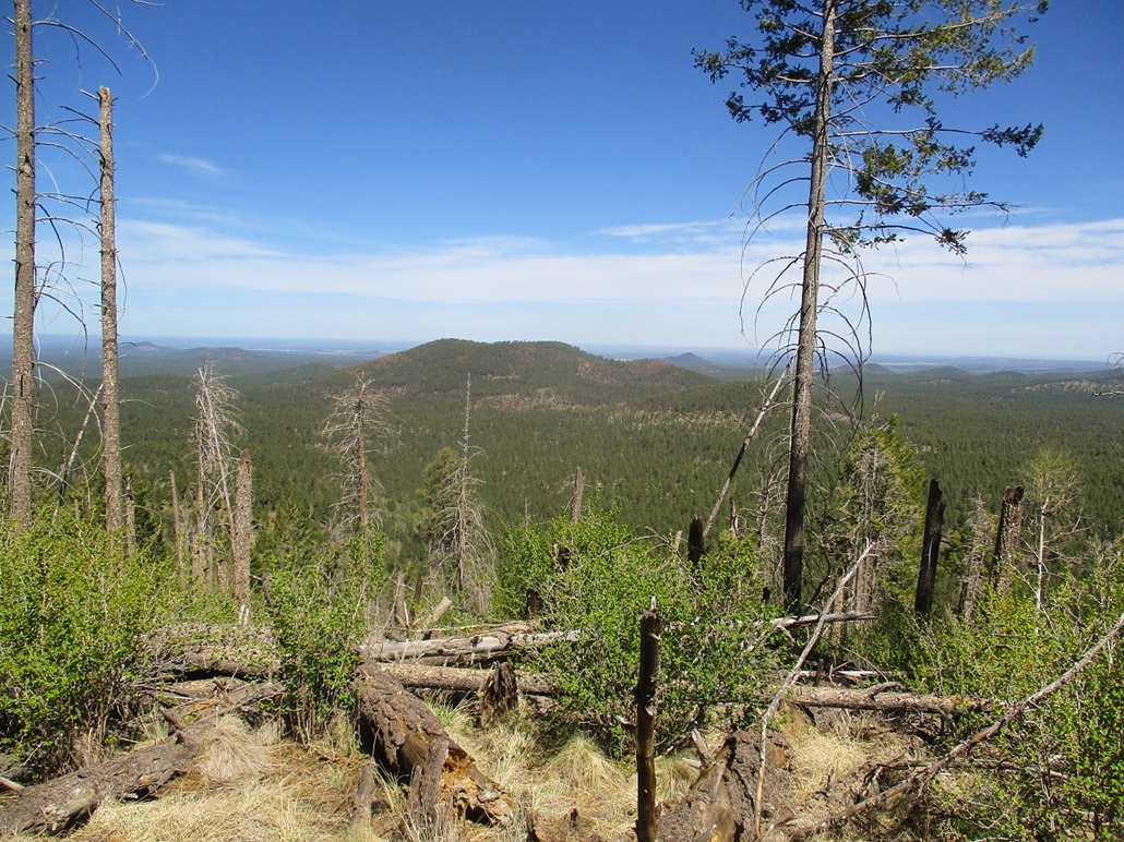
I was a half mile from the summit, to its southeast. I locked the car and started hiking directly uphill. The forest was thick, then thicker. The undergrowth was light so I could move easily, but the trees grew so close so as to create dark shade for long segments. Although a short hike, I still needed to pay attention to landmarks. Big Cerro Gordo Peak, which lies a mile to the southeast on the Fort Apache Indian Reservation, could be seen through the trees and it would serve as a good reference point for the hike down.
I soon reached a ridge, this one trending more to the south. I angled north and started up this ridge. Here, I found the faintest of trails, so evidently there had been a trail up here, but where it started, I have no idea. I kept to this trail a couple hundred yards, came to a single surveyors ribbon tied to a tree, then up more slope to the wooded top. The one-way hike took just 20 minutes, with about 550 feet of gain.
I found a register in a cairn and signed in. The register was packed with paper and went back awhile. I was surprised so many people have climbed this peak. I did not stay long and started down, now trying to follow my tracks out. I did not use a GPS, but I did mark a couple turns along the way plus memorize a couple odd logs. All this helped. Once down on the steeper slope, I could see Cerro Gordo, and boom, there was my car. I came right out to it. The hike took just 40 minutes.
My next objective was Pierce Mountain, which lies to the south. I really had no keen interest in it but it was close and I wanted to drive some of the approach road for future reference. Whereas this hike had gone well with no scratches, Pierce would be nothing but scratchy brush and downed logs.
Elevation: 8,670 feet
• Prominence: 400 feet
• Distance: 0.9 mile
• Time: 45 minutes
• Gain: 480 feet
• Conditions: Weather was nice, the ground sucked
Arizona
•
Main
•
PB
•
LoJ
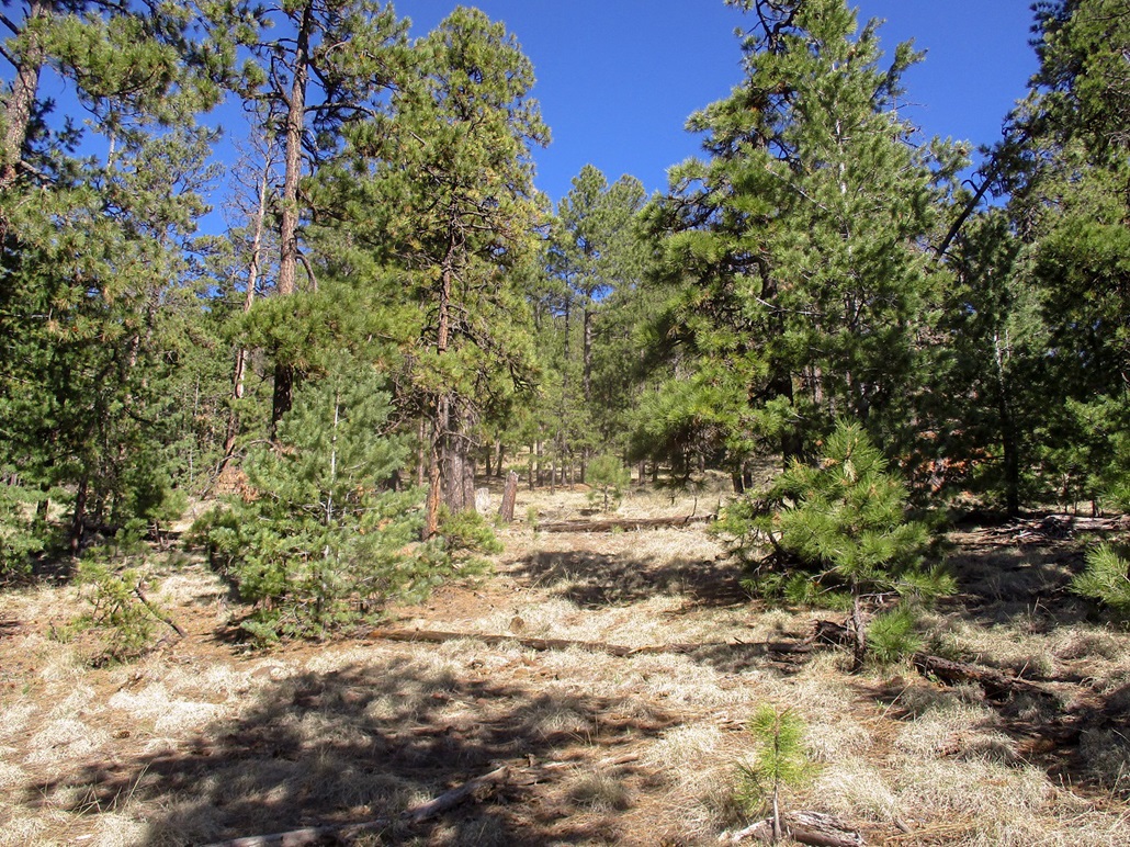
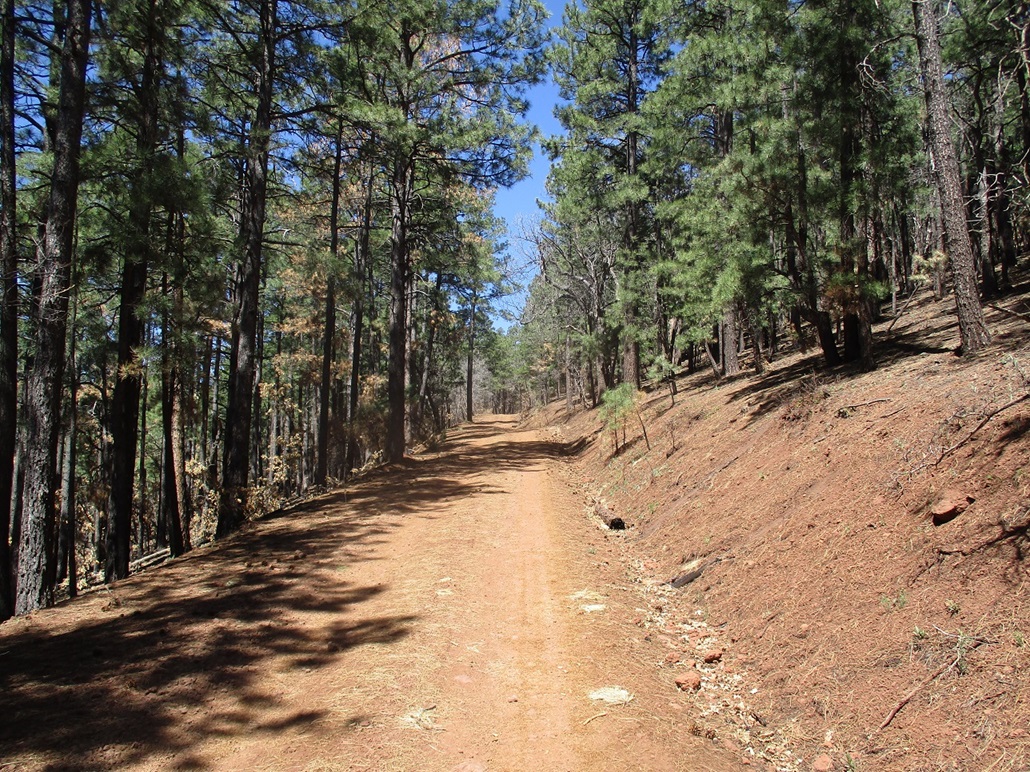
I only drove a half-mile from where I had parked hiking Wishbone Mountain. I got onto FR-9835, which wasn't too bad. Some tree branches lay in the road but I was able to ease past them. I parked in a clearing near the trailhead for Trail 631. This trail seems to go all over the place and judging by the tracks, is popular with mountain bikers.
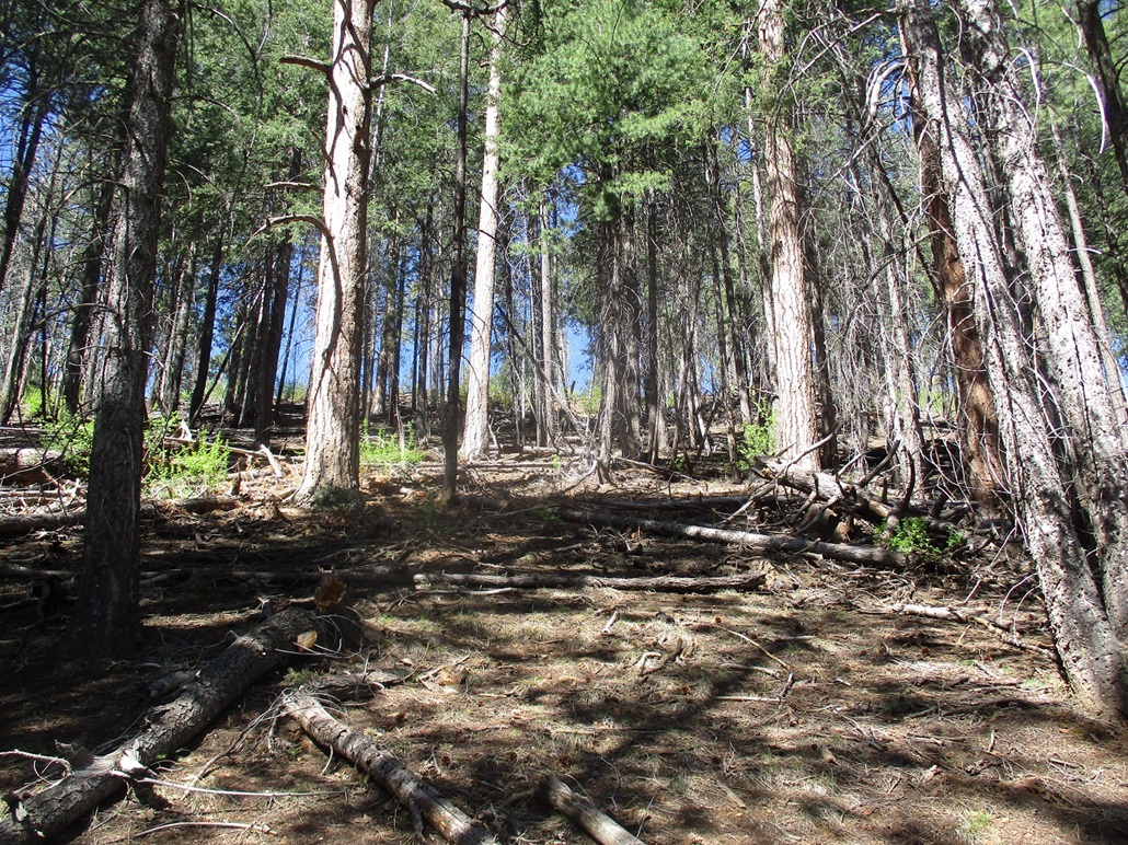
The north slopes of Pierce Mountain are mostly bare of trees, which I thought might be useful in that I could bust up slope and not have to dodge trees the whole way, plus navigation would be easy. I walked along Trail 631 past a gate, then angled upward into the light undergrowth. I soon came upon thickets of catclaw. I hoped it would pass quickly but looking up, it seemed to cover the whole bare slope.
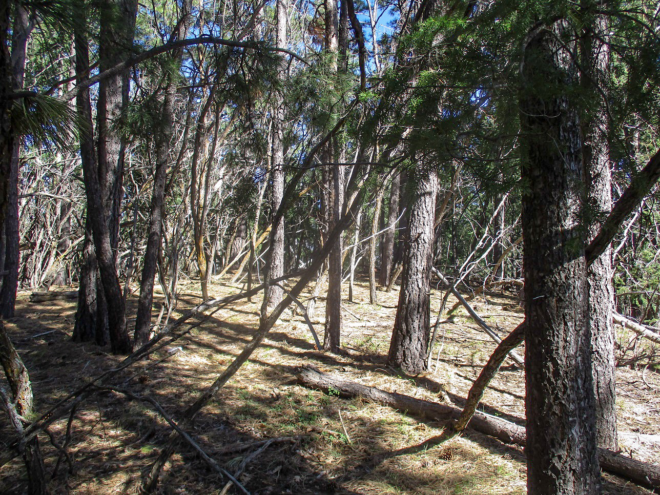
I started to sidehill eastward, looking at slopes that way and hoping there was less catclaw over that way. The good news was that the catclaw mitigated, but now had lots of fallen logs. Some looked burned, some did not. They were lying in random directions, sometimes three or four deep.
I constantly had to adjust my track to avoid the logs. I often balanced on the big ones, walking on them like a balance beam. My dismounts need work, but I was able to clamber through the logs in this manner without too many scratches and dings. My mood, though, wasn't the best. I was cussing like a sailor at times.
Finally, I was on a slope that looked promising, with few logs and catclaw. It worked, but it was a grind almost all the way up. If it wasn't logs or catclaw, it was loose tread and rubbly rock. I was on top, a small bare patch with some views due to the missing trees from whatever event made them go missing.
I did not stay up long. There was nothing to see or do and I wasn't exactly in good spirits. I descended by following a track more easterly, even finding hints of trail in spots. I could not entirely avoid the logs, but the descent route missed most of the catclaw. I was down below the slopes and to the barbed-wire fence (the same one with the gate I had to pass earlier). I got caught up in a tangle of old barbed wire lying in the grass which added scratches to my legs. You'd think I'd be upset, but I was so fed up with this hike that the barbed wire was actually a happy thing. I was all like "yay, barbed wire".
I was back to the car not long later, the whole hike taking about an hour. It did not take long but it was not a pretty hike and it was a chore. It's not worth the trouble on its own, and even if you're in the area, can be skipped without pause. I took one for the team today, climbing this ratty little peak so you don't have to.
Elevation: 8,501 feet
• Prominence: 521 feet
• Distance: 2 miles
• Time: 1 hour
• Gain: 480 feet
• Conditions: Pleasant, breezy
Arizona
•
Main
•
PB
•
LoJ
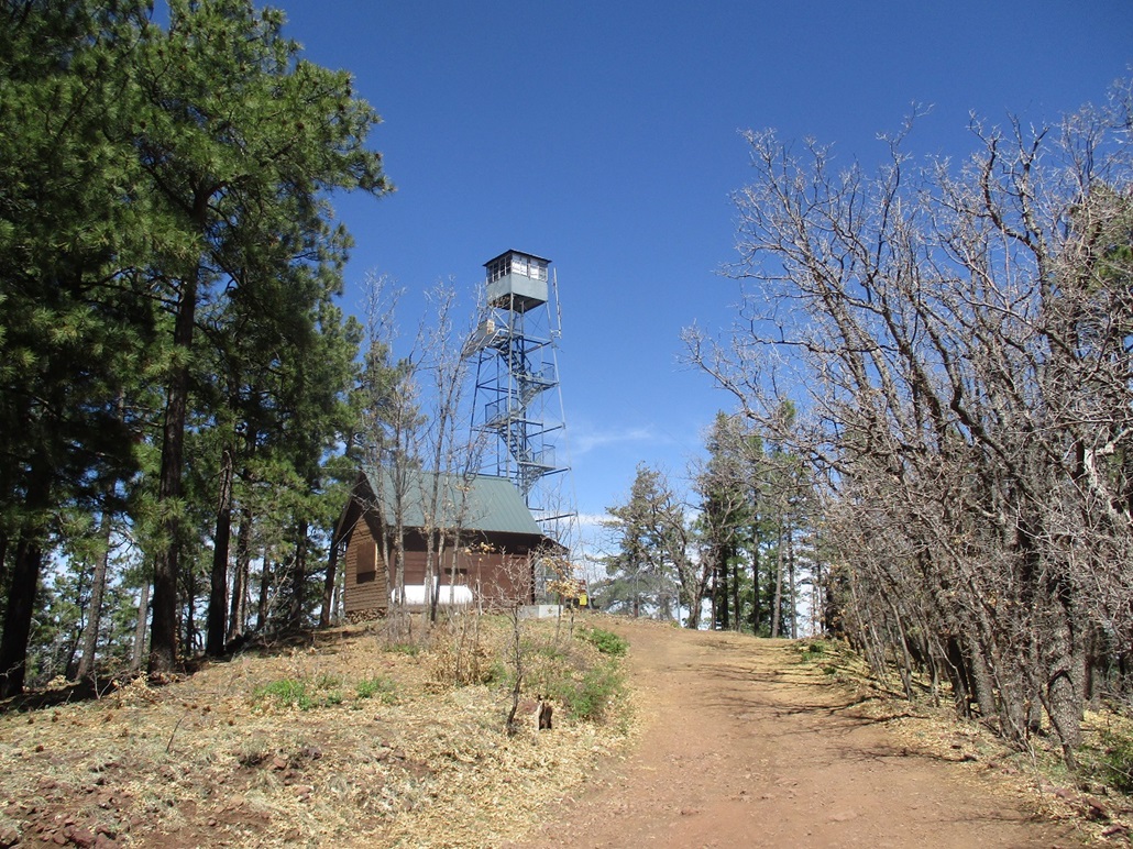
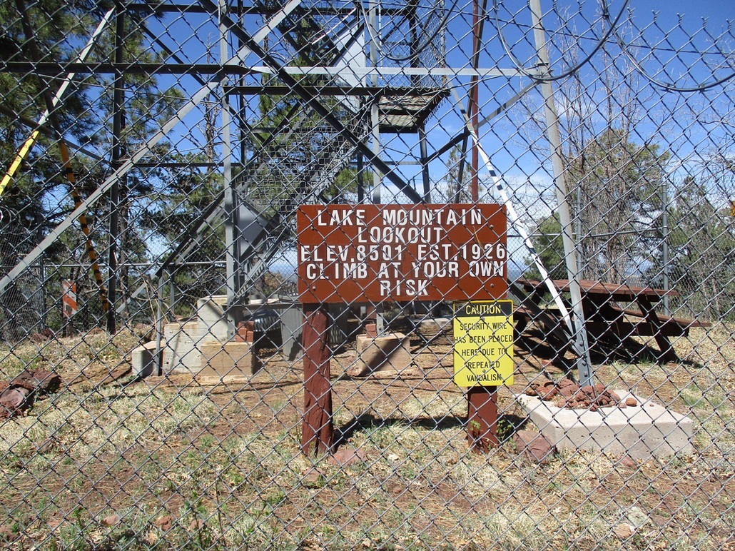
Lake Mountain was the third of three short peaks I hiked this morning, here in the forests east of Show Low. Lake Mountain has a lookout atop it, with a good road to the top, so that hiking it would be simple. I had just completed Pierce Mountain, which was close by. I was bloody from the catclaw and in my hypovolemic state, my judgement was not the best.
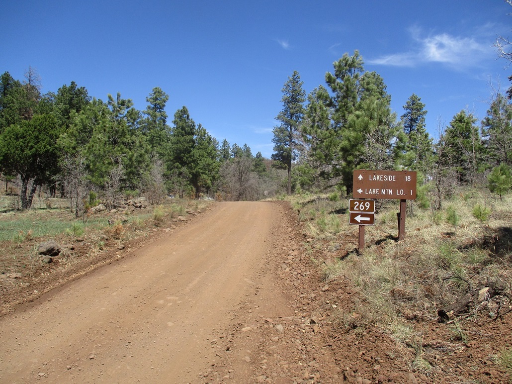
The drive to here took about 5 minutes. I drove up Forest Road 267 to FR-269, signed for the lookout, 1 mile away. I parked in a pullout and relaxed a little bit, having a quick snack. The conditions were great, with a bright sun, warm air and no clouds. It was breezy, though, getting into the gusty range often.
I walked up the road and met an older couple in camo in their Polaris. It's not hunting season as far as I know (maybe Turkey season?). They were friendly and I just wanted to be sure I would not be getting in their way. They were heading down anyway.
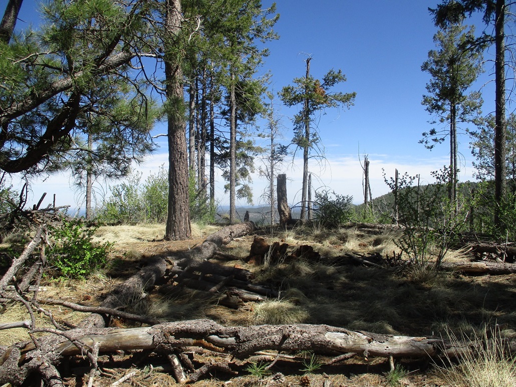
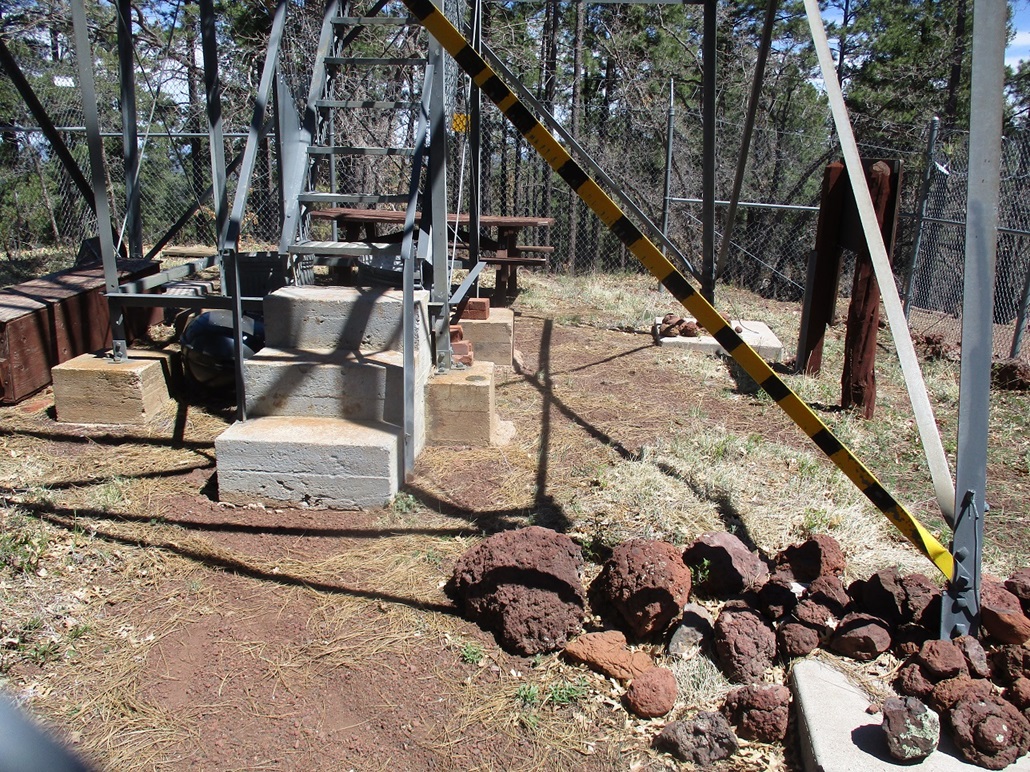
The road is normally open to vehicles but today it was closed due to the Corona Virus. The sign at the gate said the Tower was closed but nothing about prohibiting hiking. I walked around the gate and up the road, which was pitched at a lenient grade. There were fresh bootprints in the tread so others come up here, probably regularly. I enjoyed the stroll and wondered why my legs felt good. Then I looked down and did not see any cat claw or clumps of barbed wire embedding into them.
I was on top in about 20 minutes. No one was home and the tower was locked up behind fencing and razor wire. The fencing was solid so there was no way to breach it. I was bummed because the benchmark was visible, in the concrete pad below the tower. The best I could do was take an image from the outside. The highest point appeared to be on the west edge of the fencing, where land on either side of the fencing looked about the same, and maybe a couple feet higher than around front.
I sauntered around a little here, not in any hurry. The winds were picking up, though. I started down and just walked the road back to my car. My total time on the hike just about an hour.
It was only 11 a.m., and these hikes had gone a little quicker than expected. I had maps for other peaks but nothing really interested me at the moment. What I did not want was more forest bush-whacking. I used some of the time to drive out on FR-224, the main road herein, south onto the Fort Apache Indian Reservation to the small town of McNary, back to highway AZ-260. I was mainly curious if the road was open, since the Fort Apache people may have shut down some access routes due to the pandemic.
I drove into Show Low, then took a look at the Twin Knolls hills, which lie east of Porter Mountain. I rolled into the parking lot about noon, but it was warm now, and I was losing interest fast. I can easily return, so I saved this hike for a later trip and decided to head home. This being a Sunday, the roads were choked with people heading down off the plateau and back to Phoenix via Payson. Traffic was very heavy in Star Valley and Payson. The last couple miles took almost a half hour once we started hitting stop lights. But I was in good spirits and happy to be home to wash up, soothe my shredded legs, and take a nap.
|


|