The Mountains of Arizona
www.surgent.net |
|
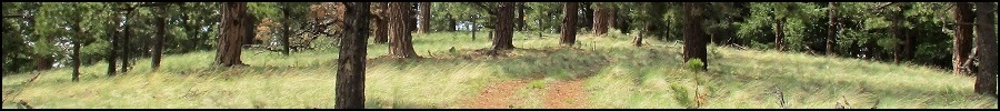
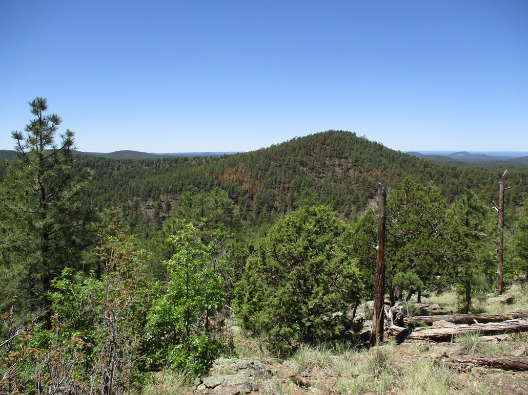
Wolf Mountain • Antelope Hills Highpoint • Morgan Mountain These three peaks lie on the Springerville Volcanic Field, about 7-10 miles east of Show Low and about the same distance north of McNary. They're all mounds of volcanic rock and cinder, covered in forest, none of them terribly exciting. Today was my third day of a three-day weekend up here in the high country visiting mountaintops. Earlier today, I hiked Cerro Hueco, a maar-crater and peak about fifteen miles northeast of here. I hoped to stick around that area and tag a couple more peaks, but after nearly stepping on a rattlesnake, I figured it be best to stay away from those grassy peaks and come up here, about a thousand feet higher in elevation, where the snakes are not likely to be seen. From Cerro Hueco, I drove back to highway US-60, then west a few miles to the turn-off onto Apache County Road 3140, called the Vernon-McNary Road since it connects the two towns, and also, once onto the Apache-Sitgreaves Forest property, signed as FR-224. It's an excellent wide hard-pack dirt road and it sees a lot of traffic. I passed through the town of Vernon, then gained elevation onto the higher lands in the forest. Being Memorial Day weekend, there were many people here camping, and this main forest thoroughfare was busy, a car every couple minutes or so, with accompanying dust. These wide, smooth forest roads can be very deceiving because it's easy to get going fast, like 50 miles per hour. But you have maybe a quarter of the traction as you would on asphalt. If you round a soft bend at that speed on this kind of road, your car may yaw and lose traction. One poor sap had run into a tree and his vehicle's front end was mashed in completely. He looked okay, fortunately, and there was a forest ranger (?) with him. Maybe it just happened. Me, I puttered along at 25-30 miles per hour. After meeting with Matthias in Springerville last night, he had been here yesterday and gave me some good information on these peaks. I've been here a few times myself, but not since 2020. Based on his suggestions, I chose to hike Wolf and Antelope Hills Highpoint first. These lie near one another and Matthias said both went fast with no difficulties. When I was in Vernon and had a signal, I downloaded some maps of the roads and peaks to have on my phone. It would not be critical, since these hikes are short with little navigational challenge, but it's always best to be safe with a backup.
Date: May 28, 2023
• Elevation: 8,288 feet
• Prominence: 528 feet
• Distance: 1 mile
• Time: 1 hour
• Gain: 518 feet
• Conditions: Sunny and warm
Arizona
•
Main
•
PB
•
LoJ
•
Interactive map
Wolf Mountain lies north of Forest Road 3, signed as Dripping Vat Springs Road on the map. In the field, it's barely signed at all. In fact, I drove right by the road at first, doubling back when I realized I had overshot it. The road is much scanter and did not look like anything special, and the road-marker stick was set in a ways and even then, I had to be literally a few feet from it to see the "3" on it. Anyway, I was now on the proper road and all was in balance again.
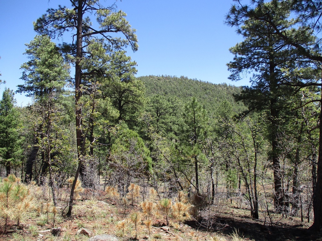
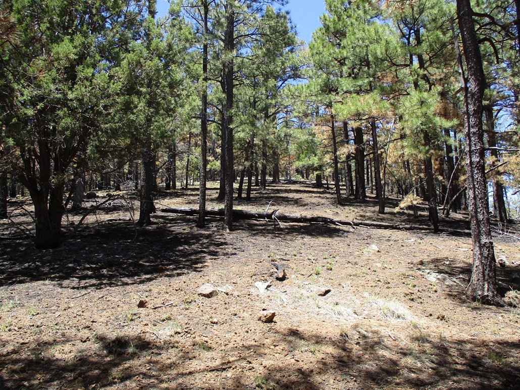
Wolf Mountain rises fairly high, having more prominence than most of the peaks in the immediate area. But the forest along the road hides it except for brief openings. When I could see it, it appeared as a steep bulky peak with some cliffs facing east, and what wasn't cliffs, was covered in trees.
I parked at the road's apex between Wolf Mountain and the Antelope Hills. It was about 11 a.m. now and a little warm, but calm with no breeze. In the shade, I felt fine. In the sun, I could feel its warmth. I locked the car and crossed the road, almost immediately gaining elevation.
The hike is just a straight-shot uphill. It's heavy forest down low, then it lightens a little and I had some good views looking south. About midway up, surface rock becomes more abundant. Brush wasn't bad and I could always find lanes. The rock helped because I could simply walk on it and avoid the brush. More toward the top, more rock appears, now forming low heaps and jumbly cliffs. The scrambling was minimal, I think I used my hands once. And then, I was on top.
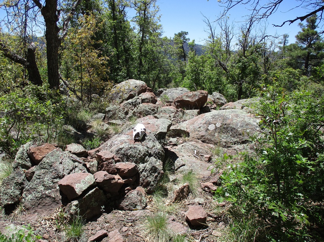
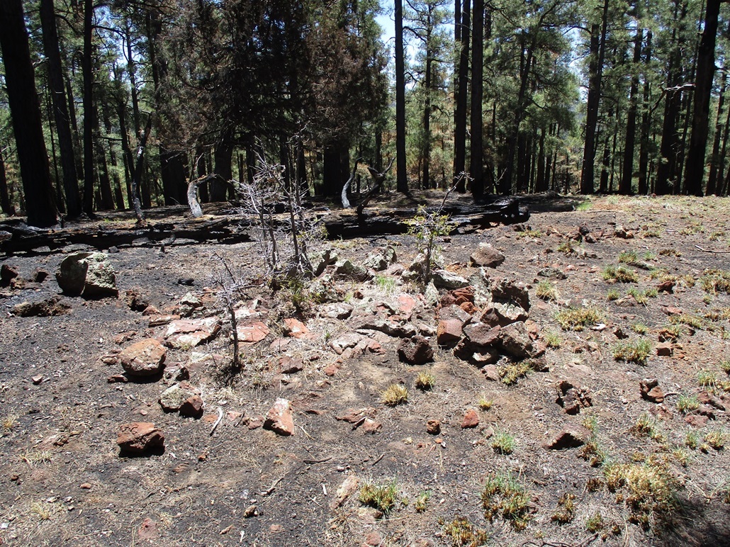
The top is forested but with views in spots. And, not surprisingly, is very rocky. I found the presumptive highest rock with a cairn and register inside it, and a skull lying atop the top rock. Is it a wolf skull? I am not sure myself. By process of elimination, I'd say "probably". Someone placed it there deliberately.
I spent just a few minutes up top. It had taken me about a half hour to climb the peak. I could feel the ambient warmth and with no breeze, I was being bopped into by flying things. I snapped a couple photos and had a drink, then started down.
I followed mainly the same route as I had coming up, not necessarily trying to be exact. It did not matter and the ridge is pretty obvious and well-defined and I would hit FR-3 no matter what. I was back to my car, total time on this hike a little less than an hour. I decided to sit inside my car a few minutes and have a longer break.
Elevation: 8,130 feet
• Prominence: 350 feet
• Distance: 0.6 mile
• Time: 40 minutes
• Gain: 360 feet
• Conditions: Warm and sunny
PB
•
LoJ
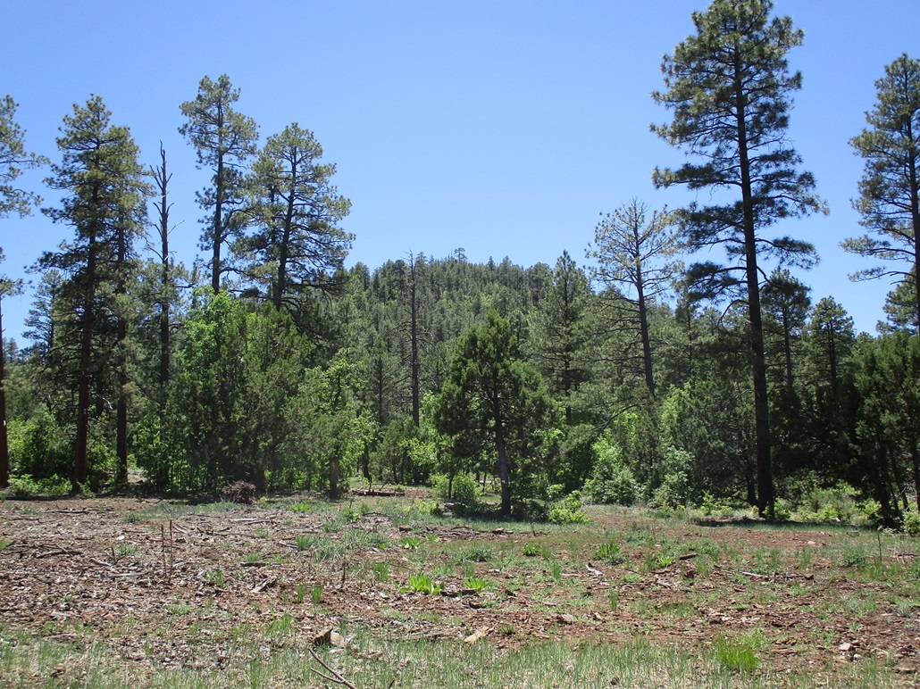
Moments later, I started hiking up Antelope Hills Highpoint. This was about as easy and straightforward a peak could be. Although forested, a recent fire had burnt off almost all the undergrowth of grass and pine needles, leaving black ash and nothing else. The grade never changed. It was a consistent ramp all the way up, with no pesky grass and brush to slow me down. I was on top in about 15 minutes.
The top here was also forested with limited views. I found a cairn and register and signed in. This peak sees a lot of visitors, relatively speaking. It's an easy peak to scale and I am sure that draws people's attention. I didn't stay long up here either.
The hike down went fast. I jog-walked the slopes all the way down and was back to my car merely 40 minutes after starting. I enjoyed this efficient little bump and had fun on it. It was nearing 1 p.m. now, and warming into the 80s. What do I do now?
I continued west on FR-3 until it fed me onto FR-267 (per the map). I went south at first but decided I didn't like that, so I went north and that fed me onto Apache County Road 3144, also known as Porter Mountain Road. This is another "major" forest highway, this one leads directly back to Show Low. I was on it westbound a few miles, turning south onto FR-182, which I followed for about two miles until I was abeam of Morgan Mountain.
Elevation: 7,646 feet
• Prominence: 366 feet
• Distance: 1 mile
• Time: 75 minutes
• Gain: 426 feet
• Conditions: Sunny, warm
PB
•
LoJ
Morgan Mountain lies west of FR-182 about a mile, but a scanter road called the Morgan Mountain Fire Road runs north of the peak. I drove this road, which was pretty good, until I was due north of the peak, and parked in a small clearing.
From below, the peak looked heavily forested, like a mat of green. As I hiked uphill, I had almost no views and generally just about 30 feet of visibility in any direction. The terrain was steep and crossed by many game paths, some of which I followed.
About a third of the way up, I decided to ignore the game paths and just bust a route straight up the slope. The undergrowth was heavy in spots with some downfall. To be safe, I ribboned my route so I could follow it back out. After about a half-hour of slogging, I was on the peak's upper ridge, where things opened up just barely. I followed the slopes uphill until I was on top.
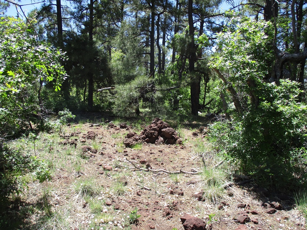
The summit was nothing to get excited about. There was a good view looking south. Otherwise, trees. I found the summit cairn and signed into the register. I saw no reason to stick around, so I turned right around and started the hike down.
The ribbons helped a lot. I wanted to keep as close to my ascent route so that I would come out to my car directly. And even then I kind of messed it up, coming out to the road about fifty feet east of my car ... but the trees were thick enough to hide my car from me even over that short a distance. This only delayed me a few seconds.
Can't say I really liked this peak very much. It was a little too forested for my preference. One, I had no views the entire way. It was like hiking beneath a canopy the whole way. And two, it does mess with navigation. Even though I had a failsafe, roads both north and east of me, I knew this could be troublesome because it would be possible to come out to the road and not know which way my car was. Everything turned out fine, and I am glad I got another one hiked, but that's about it.
Now, I was officially tired and a little warm. I wasn't eager for more peaks but really wasn't sure what I wanted to do. I got back onto FR-182 and took that all the way south to where it connects to the road net in Pinetop and highway AZ-260. I followed the highway into Pinetop-Lakeside and stopped for about an hour at a Subway to have lunch and study my map. It was Sunday, and tomorrow was Memorial Day, so I had another day open to me if I wanted it.
After my lunch, I drove into Show Low, got gas and drinks, then started south on US-60 toward Globe. I had no plan for the moment, but it had been many years since I last drove US-60 between Show Low and Globe and I wanted to enjoy the drive, plus enter into the Salt River Gorge and enjoy the views. I stopped here for about a half hour and walked the grounds, where people are allowed to walk on the older bridge, the newer auto bridge being put in about 25 years ago.
I decided I had a good weekend, I hiked 14 peaks, 13 of them ranked, and was sufficiently dirty and tired. My mind was in a good place, and once in Globe, chose to just push on home to Tempe, arriving there in the early evening.
|


|