
The Mountains of Arizona
www.surgent.net |
|
Yellow Jacket Peak • Peak 4605 • Peak 4390 These three peaks rise in the mountains south of the little town of Arivaca. The biggest peak in this area is Fraguita Peak, which I climbed back in 2023. I've been in the town and area a couple of times since then, including last May when I drove the entire length of Ruby Road. I was interested in the main sub-peak of Fraguita Peak, known as Yellow Jacket Peak. The other two peaks rose nearby with good road access, so that I could possibly get three peaks in a few hours. The weather is becoming less hot and more stable. Morning lows are in the high 50s at these elevations (mid-3000-foot) and highs in the low 80s. It would be the first nice weekend in a long time. The humidity has cleared out for the season, hopefully. I left Bisbee at 4:30 a.m. and took highway AZ-82 into Nogales, then Interstate-17 to Arivaca Road, then that into Arivaca the town, a drive of about 150 miles. In Arivaca, I went south on Ruby Road briefly, then stayed straight onto Tres Bellotas Road (FR-216). Big Fraguita Peak rose ahead, Yellow Jacket Peak to its east (my left).
Date: October 3, 2026
• Elevation: 4,997 feet ✳
• Prominence: 445 feet
• Distance: 3.8 miles
• Time: 2 hours, 10 minutes
• Gain: 1,050 feet
• Conditions: Sunny, pleasant
• Wildlife: Ratsnake, tarantula
Arizona
•
Main
•
PB
•
LoJ
I went a couple miles south on FR-216, then hung a left onto FR-4129, which becomes FR-4123 about fifty feet later, staying right. This road angles southeast, then south, eventually getting high up on a ridge east of Fraguita Peak.
The Border Patrol use this road, with one spur going to the top of one hill where they can watch the surroundings from a high perch. As a result, this road is kept up in good shape. I drove in a little under two miles, and parked when I found a good pull-out spot near a cattle grate.
It was cool and sunny, the sun still low in the east, and not a cloud in the sky. I got dressed and was moving at 7:20 a.m.. I walked the road into the hills, following it up to a saddle just east of Yellow Jacket Peak. Along the way I got a little scare with I saw a snake sunning itself in the road. It had a slimy green color and narrow head, obviously not venomous. Later, I looked it up, it was a green ratsnake.
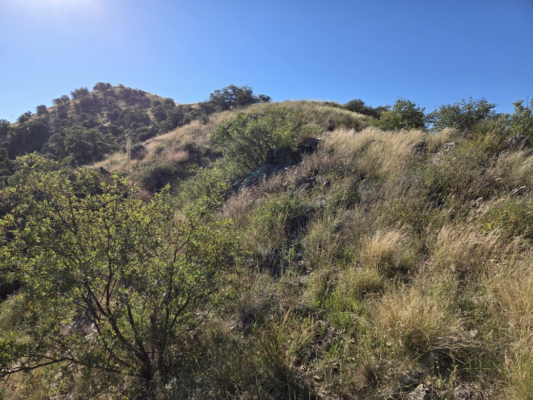
Approaching Yellow Jacket Peak, I looked for a way up the peak. From where I stood, it was one big loaf-shaped peak with steep grassy slopes and some rocks higher up. No one way looked the best.
I figured I would try to catch the peak's main ridge on its northwestern end. I turned onto an ancient miner's track which led to some old claims. This track was very grassy, and I stopped to put on my snake gaiters along the way. I got as far as the old claims. The brush, loose rock and some open pits prompted me to back off.
I picked the slope I was below and hoped it would go. It was grassy and steep, and higher up, some rocks forming low rounded cliffs. The walk up was slow as I had to be sure my footing was solid. The rocky regolith wanted to slide with the slightest pressure.
The first fifty feet was steep but straightforward. Then it got steeper, just enough to get my attention. This segment was the slowest, as the footing was never solid. I angled toward the rocks, thinking they might offer stability.
I got to the base of the rocks. It didn't look smart to scale them directly. They were steep with loose flakes and a lot of brush within their voids. Instead, I walked on the rock-slope margin, gaining about 40 feet, until I found a slope to scamper up. Now I was amid some low trees on slightly less-steep slope. The ridge was just another two minute walk. I had gained about 200 feet to here.
Now on the main ridge, the slope was much less severe and the footing much more solid. It was rocky, grassy and brushy, but I was okay with that. I just moved slowly, even following paths in some places.
This ridge portion went well. I had to move slowly, but I made steady gains and was soon on top of Yellow Jacket Peak, 70 minutes after starting. The summit was just a blank grassy mound. I found a meager rock cairn but no register. The day was sunny and very pleasant and I spent a few moments taking images. There was no reason to stick around or to sit down, so I just kept moving, now going down.
I retraced my route along the ridge, then dropped down the same exact slope I had taken up. As long as I moved slowly, it went well, but every single footfall caused some rocks to slide. I just plugged along, and soon was off the slope and back on the miner's track.
The rest of the walk went much quicker, being on roads by now. Some Border Patrol guys had driven up the road when I was on the slope (they probably glassed me), but no one drove by as I walked the road. Toward the bottom, I saw a tarantula walking in the road, so I got its image too.
I was back to my car at 9:30 a.m., a two-hour and ten-minute hike covering just under 4 miles. The road was good enough that I could have babied the Subaru up to the pass, but I was happy where I parked. I enjoyed this peak, not so much its steep slopes, and was relieved to get it finished, the first of the morning. The remaining two peaks should be easier by comparison.
Elevation: 4,605 feet ✳
• Prominence: 453 feet
• Distance: 2.8 miles
• Time: 90 minutes
• Gain: 765 feet
• Conditions: Sunny, warmer
PB
•
LoJ
The next peak rose a couple miles west, following Tres Bellotas Road then onto a lesser track, marked FR-4108, heading up Placerito Canyon. I eased the car up this track, which was in better shape than I expected. I drove to where the road makes a split, the left now FR-4108A, and got in another few hundred feet before parking in a grassy area just below a hill. The drive took about fifteen minutes.
Peak 4605 rose in the near distance. The peak's massif consists of two main summits, with the highpoint on the west. I would discover that the highpoint was not visible from where I parked, being "hidden" by a ridge bump. But it was obvious which way to go.
I walked the road a little under a mile to its end. Its condition worsened considerably. I may have got the Subaru in another eighth of a mile, but afterwards, an ATV would be best. The walk to the end of the road took about twenty minutes.
I aimed uphill, now in the tall grass, and found a path. It was definitely a path, not a trick of the eye. It went up and angled left, toward the saddle between the two main summits. The path fed me onto the saddle. A cache of large water bottles was here, but no people or evidence of recent visitors.
Now I marched up the slope in front of me. The path seemed to go this way too so I kept to it. It angled right, slightly offset from the main ridge. It curled around to a tiny saddle, then uphill to the higher ridge. Up ahead was a bump I thought was the summit.
I walked up this slope, by now no evidence of a path, but with openings to follow. I got to the top of the bump, only to discover the true summit was still a short ways ahead. I dropped about twenty feet, then up to the proper summit. It had taken me 45 minutes.
This was also a bland, open grassy summit. I found a register placed here by Amy earlier in the year. I stopped to sign in and have a drink. It was sunny with good lighting for photos, but it was also warm, pushing 80°. I was feeling good.
For the hike down, I followed the same routes down, no reason to get clever. It was about the same amount of time to egress as going up. amd I was back to my car at 11:15 a.m., a 90-minute hike. Now it was very warm, mid 80s.
A tank down below is called Cloud Mountain Tank, which makes me wonder if this peak was once known by that name. But I could find no evidence to support this. Another good name for this peak would be Placerito Peak.
Elevation: 4,390 feet ✳
• Prominence: 383 feet
• Distance: 0.6 mile
• Time: 45 minutes
• Gain: 383 feet
• Conditions: Hot now
PB
•
LoJ
I drove out the track back to the main road, only going a mile or so, to the the pass north of Fraguita Peak. Peak 4390 rises north of this pass, a steep-sloped bump of a peak. I was tired by now and it was warm. I could have easily skipped it and started home.
I pulled into a cleared area off the road and looked at the slope. It was steep but it looked hikable. This would be the shortest peak of the three, about 0.3 mile each way. I willed myself out of my front seat and started up the thing, the time 11:30 a.m., temperatures now in the mid-80s.
The lower slope was mostly open, but higher up, I found myself within very thick stands of ocotillo, with mesquite trees mixed in. The ocotillo were leafing out, their leaves yellow, getting ready to be shed I presume.
The uphill was steep and I moved slowly. The ocotillo stalks often lean into one another so finding ways through them could be tough. At their thickest, they can be impenetrable.
Finally, the slope moderated. It was level for a few feet, and up ahead was one more bump, and more ocotillo to wander through. I was soon above that, and onto the grassy ridge of this bump. A few moments later, I arrived onto the summit, about a twenty-minute hike.
The top was marked by a rockpile but no register. Someone had stuck an arrow into the rocks. To the north was another summit, possibly as high as where I stood. I got out my thang, and looked it up on the internet, and Lidar shows that where I stood was the summit. Good, because I had no desire to walk that extra little bit.
I shot a couple images but turned right around and walked down. It took about the same time to walk down. The ocotillo forced me to go slow, then lower down, those steep slopes also forced me to ensure my footing was solid. I was out in 45 minutes. By now it was a little after noon.
This peak was just for the stats, but I am glad I did it. I knew I'd never come back for it on its own. The heavy ocotillo made for some interesting images. With three peaks done and the temperatures in the low-hot range, I was ready to call it a day. I changed into looser driving clothes and hit the road, stopping in Arivaca for a snack and a cold drink.
This peak also has no name. Given all the yellow-leafed ocotillo I saw, I figured a good name for this peak would be Black Peak. Anyone familiar with Arizona peak-naming will see the cynicism in that statement.
I took the usual route through Nogales, Patagonia, Sonoita and Whetstone, going into Sierra Vista. I had an important errand to run.
I stopped into the gym I usually go to. I'd lost my waist/back brace, which I had bought after tweaking by back a month ago. So I went in and asked if I could check their lost and found, and by gum, there it was. I actually did not realize it was gone for a few days. Since I was there, I did a short twenty-minute workout. Then I got gas and groceries, and heaed back to Bisbee, arriving about 3:30 p.m..
|



|